Reconsidering Satilla
A Source Audit and Argument for a Sati/Itsati/Santee Origin
Abstract
The Satilla River of southern Georgia is commonly said to preserve the name of a Spanish officer or saint called “St. Illa.” The documentary record does not support such a simple derivation. The earliest identified references instead record Setilly River in 1756, Great Sitilla River in 1757, and the “Noble River Sitilly” in 1759, followed by later forms including Satilla, Santilla, and St. Ille. On their own, these spellings are suggestive but insufficient to establish the origin of the hydronym. Their significance becomes greater when considered against a body of evidence developed in previous source audits of southeastern Siouan and related place-names. Those studies documented an older Isa/Issa/Is? ethnonymic problem, the historical Ysa–Issa–Esaw sequence, the independently documented Sati–Santee equivalence in South Carolina, the Issati–Isanti–Izatys–Santee sequence among the eastern Dakota, the recurrence of Itsa’ti, Sautee, Santee, Citico and related names within a North Georgia-East Tennessee documented southeastern exchange corridor, and the possibility that central Georgia’s Echetee was an inherited geographic or corporate-town name that preceded its association with the Hitchiti and whose historical forms are better understood by sound than by modern spelling.
Placed within this established linguistic and geographic framework, Satilla becomes more than an isolated resemblance. The river stood beside a coastal exchange zone capable of supplying marine shell, fish, salt, and other resources to inland markets. Its name occurs at the southern end of a landscape in which related Sati/Itsati-type names appear at major transportation and exchange nodes. This paper argues that the Sati element offers the best explanation for the root of Satilla. Only after that identification is established is the remaining ending considered. Hitchiti -a’li, a collective suffix, provides a plausible mechanism by which Sati + -ali could have produced a form approximating Satili, unusually close to the earliest Setilly/Sitilly spellings. Under this reconstruction, St. Ille is not the source of the name but a later European reinterpretation of an Indigenous hydronym whose original meaning had been forgotten.
The River Before the Name
The Satilla River rises in southern Georgia and follows a long, winding course across the coastal plain before emptying into St. Andrews Sound between the barrier-island landscapes of southeastern Georgia. Its dark waters pass through pine country, wetlands, swamps, sandbars, and broad floodplains before reaching an estuarine environment extraordinarily rich in fish, shellfish, marine shell, and other coastal resources.
Long before Europeans attempted to spell its name, the river belonged to an Indigenous transportation landscape. Dugout canoes transformed southeastern rivers into freight corridors. Heavy loads that were difficult to carry for long distances overland could be moved by water, while trails and portages connected neighboring drainages. No river needed to provide an uninterrupted highway from coast to mountains. Cargo could move upriver, transfer across a watershed, change hands at a town or landing, and continue through another drainage.
The Satilla therefore deserves attention for reasons extending beyond etymology. It was a natural route between the Atlantic resource zone and the interior of southern Georgia.
Its name is also one of the more persistent mysteries of the region.
A familiar explanation holds that Satilla developed from the name of a Spanish officer or saint called St. Illa, Saint Illa, or a similar form. The story appears in numerous modern summaries and has been repeated so often that it can sound like settled history. Yet the explanation becomes considerably less convincing once the surviving eighteenth-century spellings are placed in chronological order.
The river did not first enter the British record as St. Illa.
It entered as Setilly.
The First Known Setilly
The earliest identified reference is particularly valuable because the name appears in a Native political context rather than merely as an anonymous label on a map.
On November 20, 1756, William Gray wrote to the commanding officer at Fort Frederica after visiting a town “up Setilly River.” There, Creek Indians warned him that armed Spaniards were moving through the region and attempting to persuade Native people to favor Spain over Britain. The report was sufficiently important to become part of colonial correspondence concerning the threat of renewed conflict and shifting Native alliances.
This is more informative than a bare hydronym.
By 1756, Setilly was the recognized name of a river with a Native settlement somewhere upstream. The name occurs in a report centered on Native informants, Native political decisions, and an Indigenous-controlled interior in which British and Spanish officials were competing for influence. Nothing in the context suggests that Gray understood the river name as a memorial to a Spanish officer or saint.
A year later, the large De Brahm–Bull–Jefferys map of South Carolina and Georgia labeled the waterway Great Sitilla River.
Then, in 1759, James Edward Powell traveled south of the Altamaha to confront unauthorized settlers who had established a settlement called New Hanover. His report describes their proposed principal town as lying thirty miles from the entrance of the “Noble River Sitilly,” on a waterway he considered one of the more substantial rivers of the southern colonies. Powell described it as navigable for large vessels for more than seventy miles and much farther by smaller craft. After dealing with the settlers on the Sitilly, the commissioners continued to Cumberland Island.
Within only three years the river therefore appears in three closely related forms:
Setilly — Sitilla — Sitilly
The sequence is important because it immediately rules out a simple chronological progression from one fixed spelling to another. Sitilla occurs between two forms ending in -illy. These were competing European representations of a spoken name.
Later maps and narratives add Satilla, Santilla, St. Ille, Saint Ille, and related forms.
The historical problem is therefore not how one correctly spelled name gradually became corrupted.
It is why Europeans repeatedly heard and represented the same Indigenous-looking sound in different ways.
A River Name as an Orthographic Control
Previous work on the Sati trade corridor used Satilla cautiously as an orthographic control case. That study did not use the river as proof of the corridor. Instead, it pointed out something methodologically important: the identity of the river is certain even though historical writers represented its name as Siti-, Santi-, Sati-, and related forms.

Because the geographical referent never changes, the Satilla record proves that these written differences can occur without representing different Indigenous words.
That lesson matters throughout southeastern historical linguistics.
Modern readers are trained by standardized spelling to treat Santee, Sati, Sitilla, Citico, Itsa’ti, and Echetee as visibly different words. Early European observers did not possess standardized Indigenous orthographies. Spanish, English, and French writers filtered unfamiliar sounds through their own spelling conventions. Vowels shifted. Nasalization might be written in one language and omitted in another. Affricates and aspirated sounds could be represented in radically different ways. An unstressed final vowel might appear as -i, -y, -a, or -e.
The Satilla record demonstrates that this is not merely theoretical.
Setilly, Sitilla, Sitilly, Santilla, Satilla, and St. Ille all referred to the same river.
The name must therefore be approached first as sound and only secondarily as spelling.
That principle had already become critical in the preceding Echetee investigation.
The Southeastern Atlantic Siouan Background
Satilla is difficult to interpret if treated as an isolated word. The direct documentary evidence is simply too limited. That limitation was one reason the preceding studies approached the larger naming problem from places where more evidence survived.
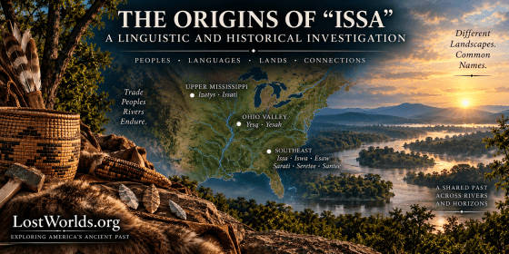
Those studies began with the possibility that an older Isa/Issa/Is? ethnonymic stem circulated among Siouan-Catawban peoples before the historically standardized form Santee became dominant. The recurrence of Ysa, Issa, Esaw, Yes?, Issati, Isanti, Sati, and related forms was not treated as proof that every name had a single origin. Instead, the evidence established that such forms existed within a connected family of Siouan and Catawban historical names and that later local explanations could not automatically be assumed to preserve their original etymologies.
The subsequent source audit of Ysa, Issa, Esaw, and Iswa strengthened that conclusion by separating the early documentary names from later scholarly interpretation; i.e., the argument that Iswa, the autonym for the Catawba, derived from Ysa/Issa/Esaw despite Pardo’s sixteenth-century records treating Ysa as a polity distinct from Cataba. The familiar equation of this historical sequence with Catawba Iswa did not originate in those early records but instead in scholarly reconstructions based not on the phonetics/sounds of the words but instead on the appearance of the words in written form which left the insertion of a medial /w/ linguistically unexplained.
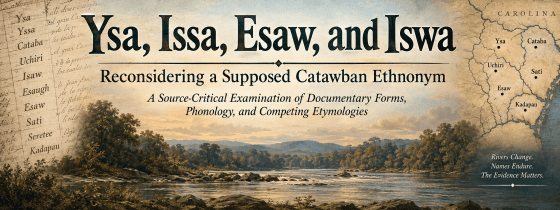
The importance of that finding was methodological. A name could become deeply associated with a later population and even acquire an apparently convincing interpretation in that population’s language without proving that the explanation represented the name’s original meaning.
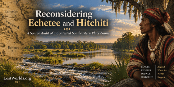
The same problem arose again with Echetee.
Echetee, Itsati, and the Problem of Spelling
The Echetee source audit began from a simple observation: visually comparing modern standardized spellings can conceal relationships that become much more plausible when the historical pronunciations are compared instead.
Echetee, Echeta, Hitchiti, Itsa’ti, Echota, and Chota look quite different on a printed page.
Their historical sounds were much closer.
The important comparison is not between blocks of modern letters but between spoken forms approximating ee-tsa-ti, ee-cha-ti, ee-che-ti, ee-cha-ta, eet-sha-tee, and related renderings. Different European ears and orthographic systems could represent an affricate, aspiration, unstressed vowel, or syllable boundary in different ways.
Cherokee Itsa’ti provides a particularly revealing example. The same inherited place-name is represented historically through forms conventionally written Echota and Chota. The visual difference between Itsa’ti and Echota is considerable. The phonetic distance is much smaller.
That finding matters directly to the Satilla problem because it provides another independent demonstration that sound must precede spelling when comparing southeastern Indigenous names.
The Echetee study also developed a second important argument. The historical Hitchiti people were not necessarily the creators of the Echetee name. Gatschet reported that they were said to have acquired their name from Hitchiti Creek, while their own older self-designation was remembered differently as A’tcik hå?ta. Mitchell’s Echetee O.T., or Echetee Old Town, further demonstrates that the Echetee name remained attached to an earlier locality after population movement.
A southeastern name could therefore survive as a place-name, become associated with later occupants, travel with a corporate community, and eventually be interpreted by outsiders as an ethnic designation.
This is precisely the kind of mechanism needed to explain why similar names might survive in places occupied at different times by peoples speaking different languages.
It also places Echetee in an important geographical position.
Echetee at the Center
The Echetee argument is not relevant to Satilla only because the names have comparable stems (ee-SHA-TEE / SA-TEE-la). Echetee also occupies the middle of the broader transportation landscape.
Mitchell’s Echetee O.T. (Old Town) belongs to the central Georgia/Ocmulgee–Ochesee world. South and east lay the Atlantic coastal plain and the Satilla River. North and east lay the routes toward Augusta and the Savannah River fall line. Beyond Augusta, established Native trails such as the Lacoda Trail led toward Tallulah and Nacoochee where the next set of Itsa’ti, Sautee, and Santee placenames congregate and the linguistic, archaeological, and ceremonial evidence converges more strongly.
What matters is that Echetee sat near the center of the exchange geography rather than on its margins. It sat at a location either near or at modern-day Ocmulgee Mounds. And this independently investigated Sati/Itsati-like name occurs at the central Georgia redistribution zone between a southern coastal river and the north Georgia mountain corridor.
Nacoochee: Trade, Mounds, and Itsa’ti
As established in previous research, “The Sati Corridor,” the Nacoochee Valley sits at a natural gateway between the Georgia Piedmont and the southern Appalachians. Archaeological evidence demonstrates that the people occupying this landscape participated in long-distance exchange.
Excavation of the Nacoochee Mound recovered marine conch, copper objects, galena, mica, hematite, quartz crystal, stone objects, and other materials whose sources lay far beyond the immediate valley. Marine shell alone establishes a connection with distant coastal environments. Copper, galena, and other exotic materials demonstrate participation in an exchange system drawing commodities from several directions.
The significance of the place-name evidence emerges against that independently established commercial background.
The surrounding landscape preserves Sautee. Historical geography preserves Santee in the immediate Nacoochee region. A 1911 White County map still marks a Santee locality just south of Nacoochee.
Most important, James Mooney recorded Itsa’ti in connection with this same landscape.
Heye, Hodge, and Pepper, in their 1918 report on the Nacoochee Mound, specifically noted Mooney’s statement that Itsa’ti was applied to the Nacoochee mound, while the same name was also associated with Little Echota on the Little Tennessee and Echota on Sautee Creek. Echota itself was shown to be phonetically similar to Echetee in previous research.
This is far more important than a superficial similarity between two place-names.
Itsa’ti was attached to a mound.
That mound stood in a valley participating in long-distance exchange.
The same immediate landscape preserved Sautee and Santee forms.
And the route leading into the valley connected it with the Savannah River trading gateway and the broader southeastern interior.
The Nacoochee evidence therefore combines the very categories that matter most to the larger hypothesis: name, mound, exchange, and transportation geography.
South Carolina supplies an independent historical counterpart.
The South Carolina Sati
In 1609, Francisco Fernández de Écija recorded a Native town and people called Sati while exploring the river system later known to the English as the Santee.
John R. Swanton examined Écija’s account in 1916 and concluded that there was little doubt that these Sati were the people later known as the Santee. He further observed that the n appearing in the English form could represent nasalization that Spanish writers had not expressed.
This is one of the strongest pieces of evidence in the entire name complex because the relationship does not depend upon resemblance alone.
Sati and Santee are historically documented names for the same southeastern Siouan people.
The South Carolina evidence also provides the economic context that the Satilla hypothesis requires.
Écija’s informants described people traveling between the interior and coast with cloaks and other commodities, including copper and silver, which were exchanged for fish and salt. His expedition encountered Sati within a settled agricultural landscape of houses and maize fields. The picture is unmistakably one of riverine movement connecting inland commodities with coastal resources.
That is essentially the commercial relationship proposed for southern Georgia.
The importance of Sati is therefore not merely linguistic. A historically documented southeastern Atlantic Siouan people bearing the relevant name were involved in the movement of goods between ecological regions through a river system.
They were also associated with mounds.
The Santee Mound Connection
John Lawson left the clearest eyewitness description of Santee burial mounds after visiting the Santee during his 1700–1701 journey through Carolina. Near their cabins, he saw several tombs, the largest of which was the burial place of a recently deceased Santee king. Lawson described their normal form as a “Mole or Pyramid of Earth” whose surface was carefully smoothed and whose height varied according to the status of the deceased. A rooflike shelter supported by posts stood on top, and relatives decorated the grave with gourds, feathers, and other memorial objects.
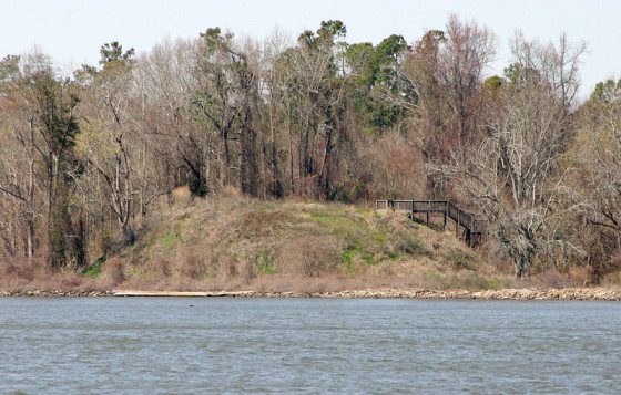
Later Smithsonian research identified a probable Santee settlement at Scott’s Lake on the Santee River. The site included an earthen mound surrounded by pottery and other settlement debris, and researchers considered it a plausible candidate for the locality Lawson had visited.
The archaeological and ethnohistoric evidence therefore places the historic Santee within a mound-building and mound-using tradition.
This does not prove that the Nacoochee Mound was built by South Carolina Santee migrants. That is not required.
The more important observation is that the Sati/Santee name occurs independently in South Carolina among a Siouan population associated with river trade and mound ceremonialism, while the related Itsa’ti name was specifically attached to the Nacoochee Mound in north Georgia with the nearby placenames of Santee and Sautee.
The connection therefore operates simultaneously at several levels:
Sati/Santee name.
Riverine exchange.
Mound-centered community life.
And a southeastern transportation landscape linking coast and interior.
Satilla now enters a much richer evidentiary world than it possesses on its own.
The Coastal End: Yufera and Cumberland
If the Satilla River really was derived from the Siouan Sati and formed part of the long-range trade corridor associated with other Itsa’ti/Sati place-names, then evidence of that trade should exist in the Satilla River region. It does.
Archaeological evidence and early European eyewitness accounts show that the lower Satilla participated in a vigorous exchange economy linking the Atlantic coast with the interior. Immediately to the south and southeast were the Timucuan communities associated with Yufera on the mainland and San Pedro on Cumberland Island. The Spanish record is especially striking because both were represented by female political authority. During Governor Pedro de Ibarra’s 1604 visitation, the ruler of Yufera was explicitly identified as a cacica, a female chief. She acknowledged no other chief as her superior and instead described herself and her people as allies—essentially “sisters in arms”—with the cacica of San Pedro. At San Pedro, the principal ruler was Doña María Meléndez, identified as cabeza y cacica, “head and chief.”
The political detail is interesting, but the economic geography is more important to the present argument. Yufera occupied the mainland south of the Satilla, while San Pedro was the principal Tacatacuru community on Cumberland Island and maintained relationships with numerous neighboring and inland settlements. These communities lived beside extraordinarily productive fisheries, oyster beds, marine-shell resources, hunting territory, agricultural land, and coastal environments capable of supplying salt and other commodities valuable to inland populations.
The archaeological geography reveals traffic moving in both directions. Nacoochee itself lay within the north Georgia gold belt, where rich placer deposits occur in the valley and surrounding mountain streams. The broader Piedmont and Appalachian interior supplied copper, lithic stone, red ocher, pigments, and other valued materials. At the opposite end of the proposed corridor, archaeological analysis of the Yufera region identifies gold, copper, red ocher, and imported lithic material as commodities entering the coastal plain from the interior through the Satilla River route. The exchange therefore did not move only from the coast inland. Valuable Piedmont and mountain commodities were traveling south while marine shell, fish, salt, cassina, hides, maize, and other coastal products were available to move north.
Early European accounts show how readily these Native communities entered exchange relationships with outsiders. The French around Fort Caroline obtained maize, fish, deer, turkeys, skins, cassina, and other provisions from neighboring Timucuan communities in return for axes, knives, beads, mirrors, cloth, and other European goods. They also reported receiving gold, silver, copper, and mineral specimens through Native trade networks extending toward the interior and Appalachian country. The Spanish encountered the same commercial flexibility. European beads, bells, cloth, iron tools, and ceramics entered Native communities rapidly, while Native people supplied food, maize, hides, pottery, transportation, and other resources in return.
The scale of Native surplus production is especially clear at San Pedro. In 1592, the Spanish purchased 263 arrobas of maize—roughly three metric tons—from the chief of San Pedro in a single transaction. San Pedro subsequently supplied St. Augustine during periods of food shortage. Such quantities show that coastal communities could assemble agricultural surpluses far beyond immediate household consumption and redirect them into regional exchange. When French and Spanish newcomers arrived with desirable commodities, Native communities did not have to invent a commercial system to accommodate them. The newcomers were simply inserted into an economy in which exchange with other communities was already normal.
That point is crucial to the Sati hypothesis. Yufera and San Pedro need not have been Siouan, and there is no reason to suggest that they controlled the larger trade network. They were Timucuan communities occupying and exploiting a productive coastal environment. Their role was as local producers and suppliers within a broader system. A Timucuan producer at Yufera or Cumberland could supply marine shell, dried fish, salt, hides, maize, cassina, or other coastal commodities, while merchants arriving through inland exchange networks could bring gold, copper, pigments, lithic material, and other goods from the Piedmont and Appalachian interior.
The same merchant did not necessarily carry an object from its original source to its final destination. Commodities could change hands repeatedly at towns, river landings, and exchange nodes. What mattered was the network of relationships that kept those goods moving. The historically documented South Carolina Sati provide evidence for precisely this kind of riverine commercial economy, in which inland goods moved toward the coast and coastal products moved in the opposite direction.
This reciprocal exchange helps explain why a merchant network would have developed along the Satilla in the first place. The two ends of the route possessed complementary resources that the other lacked. Interior centers such as Nacoochee lay near sources of gold and other mountain commodities, while Yufera, Cumberland, and the surrounding coastal settlements offered shell, marine foods, salt, agricultural surplus, and other products. The Satilla provided the transportation artery connecting those economic worlds.
No distinctive Siouan pottery or other culturally diagnostic artifact assemblage need be expected in such a system. Merchant communities could reside among local populations, form kinship relationships, eat local foods, and use locally manufactured pottery while continuing to maintain distant commercial ties. Their archaeological footprint might therefore be far less obvious than the exotic commodities moving through the places where they operated.
That makes the hydronym itself especially significant. If Setilly/Sitilly/Satilla preserves the Sati name, then the river name may be one of the clearest surviving traces of who some of the principal long-distance merchants using this corridor were. The Sati did not need to rule Yufera or San Pedro. They needed only to be sufficiently associated with the movement of goods along this particular river for their name to become attached to it.
Before Santee: The Older Issa Problem
The South Carolina Sati ? Santee equivalence establishes the immediate linguistic anchor for Satilla.
But the earlier studies showed that Santee itself is not the beginning of the naming problem.
Before Santee: The Issa–Is? Ethnonymic Stem in Siouan-Catawban Historical Onomastics examined the recurrence of Isa/Issa/Is?-type names among geographically separated but linguistically related peoples. Forms such as Ysa, Issa, Esaw, Yes?, Issati, Isanti, and others suggested that an older ethnonymic or corporate-name stem may have circulated through Siouan-Catawban communities before individual languages remodeled or reinterpreted it.
The argument did not require every form to descend mechanically from one original word. Names can travel horizontally as well as vertically. They can spread through migration, alliance, intermarriage, incorporation, and trade. Once incorporated into another language, an inherited name may acquire a locally meaningful explanation that obscures its earlier history.
The later Ysa/Issa/Esaw source audit provided a concrete example of why this matters. A historical name sequence could become associated retrospectively with a convenient later-language explanation that was not actually demonstrated by the earlier sources.
That principle applies directly to Satilla.
A later interpretation of an old name does not necessarily reveal its origin.
The clearest independent control comes from the Dakota Santee.
The Dakota Santee as a Control
The eastern Dakota provide a remarkable comparison because no Satilla hypothesis is required to produce their historical spellings.
French and English records preserve forms including:
Izatys — Issati — Isanti — Santee
Neighboring Native languages provide additional renderings. Hidatsa records an i-tsa-ti type form for the Santee Dakota, while an Arikara form approximates sa-ti.
These are not names being grouped together merely because they sound alike.
They refer to the same historically documented Santee population.
That makes the Dakota material a control case.
It proves that a Siouan ethnonym standardized by English speakers as Santee could legitimately appear through other languages and orthographies as Issati, Isanti, Izaty, i-tsa-ti, and sa-ti.
This does not prove that the Dakota Santee founded Satilla, Nacoochee, or Echetee. Nor does it require a recent migration between the northern Plains and Georgia.
Its evidentiary value is more precise.
The Dakota evidence demonstrates that the kinds of transformations required by the southeastern argument are real transformations documented within another Siouan language environment.
Thus a southeastern comparison among Sati, Santee, Itsa’ti, Sautee, and related forms cannot be dismissed merely because modern spelling makes them look different.
The control shows that the phonetic range is historically plausible.
The South Carolina Sati then show that this naming problem actually existed within the southeastern Atlantic Siouan world itself.
Only after this foundation is established does the Satilla name become meaningful.
Returning to Satilla: The Sati Element
The root of the river name should be considered before its ending. The earliest identified forms are:
Setilly — Sitilla — Sitilly
Later forms include:
Satilla — Santilla — St. Ille
The initial syllable therefore moves among something approximating Se-, Si-, Sa-, and San- without any change in the identity of the river.
That variation closely parallels what the preceding evidence predicts. Spanish Sati and English Santee referred to the same South Carolina Siouan people. The Dakota Santee appear as Issati, Isanti, Izatys, and Santee. Hidatsa rendered their name approximately i-tsa-ti. The southeastern place-name landscape contains Itsa’ti. And the Satilla itself alternates historically among Siti-, Santi-, and Sati- forms.
The most economical interpretation is therefore that the first portion of Satilla belongs to the Sati/Issati naming complex rather than to the abbreviation St.
The name begins to make geographical sense as well. A Sati-like hydronym occurs at a southern Atlantic river beside a major coastal resource zone. A documented Sati/Santee population occupied another Atlantic river system farther north and participated in coast-to-interior canoe trade. An Itsa’ti name was attached to the Nacoochee Mound within an interior exchange gateway containing marine shell and other nonlocal goods. Echetee occupied the central Georgia landscape between the southern coastal zone and this northern gateway.
The Sati interpretation therefore rests on more than sound alone.
The sound occurs inside the expected geography.
Why the Ending Is Longer: Hitchiti -a’li
Once the Sati root has been established, a narrower problem remains. Why does the river name contain an additional -li / -lla / -illy element? This is where Hitchiti morphology becomes relevant.
Albert S. Gatschet documented a Hitchiti collective suffix -a’li. He illustrated its function with formations referring to classes or bodies of people. The suffix expresses collectivity—a body or group of people.
That distinction matters.
The proposed derivation is not “Sati + a suffix meaning river” or “Sati + a suffix meaning place.” It is more plausibly a form identifying a Sati collective or Sati people that subsequently became attached to a locality or river.
A historical comparison helps show how the morphology could behave. The southeastern name Tama also appears in the extended form Tamali. Rather than producing an awkward Tama-ali, the adjoining vowels collapse into the shorter form:
Tama + -ali ? Tamali
The same morphology applied to Sati would yield:
Sati + -ali ? Satili
That predicted form deserves attention because it is extraordinarily close to the earliest colonial spellings of the river:
Setilly
Sitilly
The modern standardized Satilla actually obscures the resemblance.
An English writer hearing an unstressed final -i could readily write it with -y. Another could represent the same weak final vowel as -a. The documentary record demonstrates precisely this fluctuation because Sitilla occurs between Setilly and Sitilly.
No hypothetical Indigenous change from Satili to Satilla is therefore required. The differences can arise through colonial transcription. A plausible sequence becomes:
Sati + Hitchiti -a’li ? Satili ? Setilly / Sitilly / Sitilla ? Satilla
This explanation should remain secondary to the Sati argument because the root has much stronger comparative support than the reconstructed suffixation. Nevertheless, the morphology is unusually well suited to the historical spellings.
Its geographical context is equally interesting. The central portion of the proposed trade landscape includes Echetee/Hitchiti-speaking communities. A Sati name moving through that linguistic environment could acquire Hitchiti morphology without implying that the Sati themselves were originally Hitchiti or that the name originated in a Muskogean language.
A borrowed name can be grammatically naturalized.
That is exactly the type of multilingual process documented throughout this broader investigation.
What About Santilla?
The form Santilla may initially appear to favor Saint Illa because of its written n. The South Carolina evidence shows why that conclusion is unsafe. Swanton’s analysis of Spanish Sati and English Santee explicitly treated the English n as a representation of nasalization not expressed by the Spanish form. The underlying Indigenous pronunciation could therefore generate both written Sati and Santee without representing two separate names.
The Satilla record independently reproduces the same instability. Both Satilla and Santilla were used for the same river. The appearance of n is therefore compatible with the very Sati/Santee variation already documented among southeastern Siouans. It does not require a saint.
From Sitilly to St. Ille
William Bartram’s St. Ille is a genuine historical form and should not be ignored. Its chronology is the problem. By the time Bartram used St. Ille, Setilly, Sitilla, and Sitilly had already been documented. An earlier Indigenous-looking form therefore existed before the transparently European-looking segmentation. The direction of explanation should follow the chronology.
A name pronounced approximately Sitilly or Satilly would have been opaque to an English speaker unfamiliar with its origin. Dividing the initial sound from the rest of the word immediately produced something recognizable:
Sitilly ? St. Ille
Once the river had been written as St. Ille, the next step was almost inevitable. If the abbreviation St. was present, there must have been a saint—or perhaps a Spanish officer—whose name followed it. The historical explanation could therefore grow out of the spelling rather than the spelling growing out of the historical event.
Nineteenth-century linguist Albert Gatschet was already suspicious of this tradition. When discussing southeastern river geography, he identified the modern Satilla and characterized forms such as St. Illa, Santilla, and St. Tillie as erroneous renderings. Gatschet did not provide the Sati interpretation developed here, but his observation is significant. The Spanish-saint explanation was not universally accepted even among early specialists working with Creek and Hitchiti languages.
The deeper pattern identified in the preceding papers makes the reinterpretation still more understandable. Itsa’ti survived among later Cherokee occupants even after its original meaning had become obscure. Echetee could survive as an old locality while populations moved. Ysa/Issa could later be interpreted through a Catawba Iswa explanation whose historical relationship remained unproven. And Sitilly could eventually be transformed into St. Ille once its Indigenous meaning was forgotten.
The mechanism is the same: the name survives longer than the knowledge needed to explain it.
The Cumulative Case
Taken by itself, the Satilla evidence would remain suggestive rather than compelling. No surviving document explicitly states that the river was named for Sati traders, and no Indigenous-language translation of the hydronym has yet been identified. Its significance emerges from the body of evidence established in the preceding studies.
South Carolina provides a historically documented Siouan population called Sati, later rendered Santee, whose riverine economy connected inland goods with coastal resources. North Georgia preserves Itsa’ti at Nacoochee, a major exchange center containing marine shell and other exotic materials, while Sautee and Santee forms occur in the surrounding landscape. The Echetee investigation demonstrated both that southeastern place-names could outlive population movements and that forms such as Itsa’ti, Echota, and Echetee must be compared by historical sound rather than modern spelling. The earlier Issa studies further showed that Santee belongs to a wider Siouan-Catawban naming problem in which similar ethnonyms could be inherited, borrowed, and reshaped by different languages.
The eastern Dakota provide the independent control. Their historically documented name appears as Issati, Isanti, Izatys, and ultimately Santee, while neighboring languages produced still other approximations. These are not hypothetical correspondences but variant renderings of the same known Siouan ethnonym. They demonstrate that the range of spellings encountered in the Southeast is entirely plausible within a Siouan linguistic setting.
The Satilla River then supplies its own independent sequence: Setilly, Sitilla, Sitilly, Santilla, Satilla, and eventually St. Ille. The identity of the river never changes. Only the European attempt to represent its spoken name does.
Seen against the earlier evidence, the resemblance between Satilla and Sati is therefore no longer an isolated phonetic coincidence. It occurs on a river embedded in a demonstrable long-distance exchange system, carrying interior commodities toward the coast and coastal commodities inland, precisely where a merchant-associated name would have economic meaning.
Reconstructing the Name
The strongest element of the proposed derivation is the root Sati. Spanish sources establish Sati as an early form of the South Carolina name later written Santee, while the Dakota material independently demonstrates comparable variation among Issati, Isanti, and Santee. The early Satilla spellings—particularly Setilly and Sitilly—fit comfortably within that phonetic range.
The remaining syllable may be explained through Hitchiti morphology. Gatschet documented a collective suffix -a’li, corresponding broadly to Creek -algi. Applied to Sati, such a formation could have produced something approximating Satili, identifying a Sati collective or people. The historical Tama ? Tamali formation provides a useful comparison for the contraction involved.
The proposed development is therefore:
Sati + -a’li ? Satili ? Setilly / Sitilly / Sitilla / Satilla / Santilla
The first stage remains a reconstruction, but its predicted result is strikingly close to the earliest recorded forms of the river name. The variation among -illy, -illa, and related endings need not represent changes within the Indigenous word itself; the eighteenth-century records already demonstrate that European writers rendered the same spoken hydronym differently.
The later St. Ille form is best understood in that chronology. Setilly, Sitilla, and Sitilly all appear before the transparently European-looking St. Ille. Once the original meaning of the river name had become opaque, English speakers could easily reinterpret its opening syllable as the abbreviation St. and supply a saint or Spanish namesake afterward. The documentary sequence therefore runs more naturally from an Indigenous hydronym toward St. Ille than from a hypothetical Saint Illa toward Satilla.
Conclusion
The Satilla hypothesis does not stand on the river name alone. It rests upon a sequence of independent findings developed across the preceding studies.
A southeastern Siouan people called Sati became known in English as Santee. Related Itsa’ti/Sautee/Santee names occur within an archaeological landscape of long-distance exchange extending through north Georgia and the southern Appalachians. The Echetee evidence demonstrates how inherited names could survive movement between communities and how misleading modern spellings can be when compared without reference to sound. The Dakota Issati–Isanti–Izatys–Santee sequence supplies an independent Siouan control showing that precisely this degree of phonetic and orthographic variation occurred historically.
The lower Satilla adds an economic setting consistent with that linguistic evidence. Archaeology and early European accounts reveal a river corridor through which valuable inland commodities such as gold, copper, red ocher, and lithic materials reached the coast, while marine shell, fish, salt, cassina, hides, maize, and other coastal products could move in the opposite direction. Yufera and San Pedro were local Timucuan producers and participants within that exchange world; they did not need to be Sati for Sati merchants to trade among them. The ease with which these communities later incorporated French and Spanish newcomers into their exchange relationships demonstrates how readily outside merchants could participate in the existing system.
If Setilly/Sitilly/Satilla preserves the Sati name, the hydronym may therefore mark one of the principal commercial arteries used by a merchant population whose other names survive farther inland. Such traders need not have left a distinctive pottery tradition or territorial state behind them. They could live among host communities, use local material culture, and remain visible archaeologically primarily through the movement of exotic commodities and the persistence of names attached to important transportation nodes.
The traditional St. Illa explanation begins late and requires an otherwise unidentified European namesake. The Sati interpretation instead fits the earliest spellings, the known behavior of Siouan ethnonyms, the surrounding place-name pattern, and the economic geography of the river itself.
Taken together, these lines of evidence suggest that the name Satilla may preserve something far older than a colonial saint or Spanish officer: the memory of the Sati merchants who once moved between the Atlantic coast and the southeastern interior.
References
Bartram, William. 1791. Travels Through North & South Carolina, Georgia, East & West Florida, the Cherokee Country, the Extensive Territories of the Muscogulges, or Creek Confederacy, and the Country of the Chactaws. Philadelphia: James and Johnson.
Coleman, Kenneth, and Milton Ready, eds. The Colonial Records of the State of Georgia: Original Papers of Governors Reynolds, Ellis, Wright, and Others, 1757–1763. Athens: University of Georgia Press.
Daniels, G. C. 2026. Before Santee: The Issa–Is? Ethnonymic Stem in Siouan-Catawban Historical Onomastics.
Daniels, G. C. 2026. Ysa, Issa, Esaw, and Iswa: Reconsidering a Supposed Catawban Ethnonym.
Daniels, G. C. 2026. Achito, Echeta, and Hitchiti: A Source Audit of a Supposed Name Sequence.
Daniels, G. C. 2026. Reconsidering Echetee and Hitchiti: A Source Audit of a Contested Southeastern Place-Name. LostWorlds.org.
Daniels, G. C. 2026. Reconsidering Ogechie and Ogeechee: A Source Audit of a Proposed Siouan Hydronym.
Daniels, G. C. 2026. The Sati Corridor: Tracing a Santee Merchant Route from the Savannah River through the Southern Appalachians to the Tennessee–Mississippi Exchange Network. LostWorlds.org.
De Brahm, John Gerar William, William Bull, and Thomas Jefferys. 1757. A Map of South Carolina and a Part of Georgia.
DeMallie, Raymond J., ed. 2001. Handbook of North American Indians, Volume 13: Plains. Washington, D.C.: Smithsonian Institution.
Gatschet, Albert S. 1884. A Migration Legend of the Creek Indians, with a Linguistic, Historic and Ethnographic Introduction. Vol. 1. Philadelphia: D. G. Brinton.
Heye, George G., Frederick W. Hodge, and George H. Pepper. 1918. The Nacoochee Mound in Georgia. Contributions from the Museum of the American Indian, Heye Foundation, Vol. IV, No. 3. New York.
Lawson, John. 1709. A New Voyage to Carolina. London.
Matthews, Washington. 1877. Ethnography and Philology of the Hidatsa Indians. Washington, D.C.: Government Printing Office.
Mitchell, John. 1755. A Map of the British and French Dominions in North America, with the Roads, Distances, Limits, and Extent of the Settlements.
Mooney, James. 1894. The Siouan Tribes of the East. Bureau of American Ethnology Bulletin 22. Washington, D.C.: Government Printing Office.
Mooney, James. 1900. “Myths of the Cherokee.” Nineteenth Annual Report of the Bureau of American Ethnology, 1897–98, Part 1. Washington, D.C.: Government Printing Office.
Swanton, John R. 1916. “Some Information from Spanish Sources Regarding the Siouan Tribes of the East.” Journal of the Washington Academy of Sciences 6(17): 609–612.
Swanton, John R. 1922. Early History of the Creek Indians and Their Neighbors. Bureau of American Ethnology Bulletin 73. Washington, D.C.: Government Printing Office.
Worth, John E. Transcription of Governor Pedro de Ibarra’s 1604 visitation of the mission provinces of Spanish Florida. University of West Florida.