The Sati Corridor
Tracing a Santee Merchant Route from the Savannah River through the Southern Appalachians to the Tennessee–Mississippi Exchange Network

Abstract
Previous papers in this series (Dakota Sioux Once Lived in Georgia, The Santee Merchant Guild) identified an unusual cluster of Sati/Santee-related place-names in Georgia and proposed that they may preserve the remains of a dispersed Native trading population rather than the boundaries of a conventional territorial polity. The present study extends that investigation beyond Georgia. It asks whether the geographic pattern continues north and west through the southern Appalachians and into the Tennessee River system, and whether the resulting alignment corresponds with archaeological evidence for the long-distance movement of commodities between the South Atlantic coast and the Mississippi Valley. The evidence examined here indicates that it does.
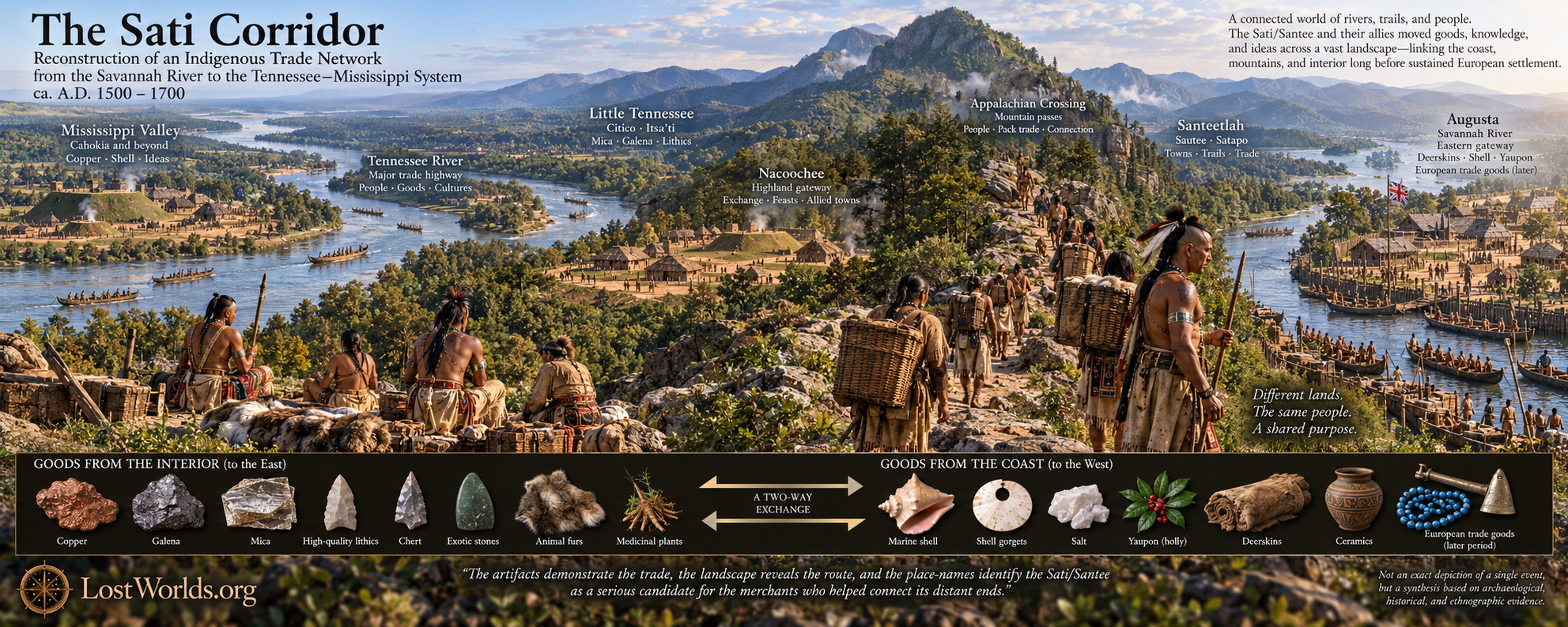
A historically documented Native route known as the Lacoda Trail connected the Savannah River near modern Augusta with the northeast Georgia mountains, passing through the Piedmont toward Tallulah and Nacoochee. From this mountain gateway, established Native routes continued across the southern Appalachians toward the Hiwassee, Tellico, and Little Tennessee valleys, which in turn opened onto the Tennessee River and the Mississippi drainage. Archaeological sites situated along or near this extended transportation system contain materials originating at considerable distances from one another, including marine shell, copper, galena, nonlocal lithic materials, and botanical commodities such as the caffeinated Ilex used to prepare Black Drink. The geographic distribution of these materials demonstrates the existence of a long-distance exchange environment independent of any hypothesis concerning the identity of its merchants. The central argument of this paper is that a second body of evidence—the recurrence of Sati, Santee, Isanti, Issati, Itsa’ti, Sautee, Santeetlah, Satapo, and Citico/Sitico-type place-names at important points within the same transportation landscape—identifies the Sati/Santee as a strong candidate for one of the populations participating in this commerce.
Generative artificial intelligence was used during the exploratory phase of the research to identify possible Sati/Santee-related toponyms and to map their geographic relationships. AI-generated suggestions were treated only as search leads and not as evidence; proposed names, spellings, routes, and historical claims were checked against maps, primary documents, archaeological reports, and established secondary scholarship before inclusion. This procedure proved useful because the pattern is geographically dispersed and obscured by several centuries of inconsistent European spelling. A particularly instructive comparison is provided by the Georgia river now standardized as Satilla, which appears historically as Sitilla, Santilla, and Satilla. This river is not treated as part of the Savannah River corridor investigated here; rather, its documented orthographic history provides an independent control case demonstrating that European writers could represent the same Native name with Siti-, Santi-, and Sati- forms. Consequently, apparent differences among similar southeastern toponyms cannot be evaluated solely by their modern spellings.
The paper concludes by considering the historically documented South Carolina Sati/Santee, the Dakota Isanti/Santee, and the possibility that their separation reflects a much older Siouan dispersal. Major periods of Siouan linguistic differentiation overlap broadly with the Hopewell era, when Georgia was already participating in exchange networks extending toward the Ohio and Mississippi valleys. Finally, sixteenth-century Spanish goods and later English commerce are considered not as origins of the network but as successive additions to it. European objects entered Native exchange systems before British colonization, while the Shawnee settlement at Savannah Town provides a documented example of a mobile Native trading population occupying the Savannah River gateway. The English subsequently inserted themselves into the same commercial geography at Savannah and Augusta, eventually transforming participation in an Indigenous exchange network into territorial colonization.
Introduction: From a Georgia Anomaly to a Continental Route
This paper is the third principal study in a sequence examining the possibility that Sati or Santee commercial communities once operated across portions of the Southeast. “Dakota Sioux Once Lived in Georgia” (Paper 1) began with an anomaly: Native names and historical references in Georgia that did not fit comfortably within conventional reconstructions of the region’s historic ethnic geography. “Reconsidering Ogechie and Ogeechee” (Paper 1a,) conceived as a source-audit companion to that study, tested the proposed relationship between Ogechie and Ogeechee and concluded that the established etymological explanations surrounding the names were considerably less secure than their repeated appearance in secondary literature suggested. That result did not prove a Santee origin for Ogeechee, but it established an important methodological point: apparently settled southeastern place-name etymologies may rest upon surprisingly unstable historical foundations.
“The Santee Merchant Guild: A Shawnee-Style Enclave Model For Siouan Trade Networks in Pre-Contact Georgia” (Paper 2) moved beyond the individual anomaly and proposed a mechanism capable of explaining geographically dispersed Sati-like names without requiring a Santee territorial state in Georgia. Drawing upon the historically documented mobility of peoples such as the Shawnee, it proposed a trade-enclave model in which small communities of merchants could occupy strategic river crossings, junctions, and transportation nodes within territories dominated by other populations. Under such conditions, merchants might leave little distinctive archaeological signature because they could use local ceramics, marry into local communities, and participate in local political systems while continuing to maintain distant commercial relationships. Their most durable traces might therefore be neither political boundaries nor a continent-wide pottery tradition, but strategically placed names.
The present paper tests the next implication of that model. If the Georgia names identified previously represent elements of a genuine commercial system rather than a local coincidence, then the pattern should not terminate arbitrarily at the Georgia state line. It should continue through the physical transportation geography that connected Georgia with the interior. More importantly, the route suggested by the names should correspond with archaeological evidence for the movement of distant commodities. The question is therefore no longer simply whether several Sati-like names existed in Georgia, but whether a recognizable Sati corridor can be followed from the Savannah River through the southern Appalachians into the Tennessee–Mississippi exchange system.
That shift in scale is significant. The present argument does not begin by asking the reader to accept a linguistic reconstruction and then search the landscape for evidence that fits it. The transportation geography and archaeological exchange network can be established independently. Only after that foundation is in place does the recurrence of Sati-related names become diagnostically important.
The Savannah River Gateway and the Lacoda Trail
The southeastern end of the corridor examined here is the Savannah River. The Savannah offered an obvious transportation artery from the Atlantic into the interior, while the fall-line region near modern Augusta created a natural transition between lower-river navigation and overland movement into the Piedmont. Long before Augusta existed, this geography made the locality strategically valuable. Later colonial development did not create the gateway; it inherited one already structured by Native travel.
The clearest documentary evidence for the inland route is preserved by G. J. N. Wilson in The Early History of Jackson County, Georgia. Wilson recorded that the “La-co-da Trail led from Augusta to the mountains,” passing through Groaning Rock, later Commerce, then through the locations of Maysville and Gillsville before continuing to the Tallulah and Nacoochee countries. Whatever the ultimate etymology of Lacoda, the route itself is historically significant because it establishes a direct transportation connection between the Savannah River fall-line region and northeast Georgia.
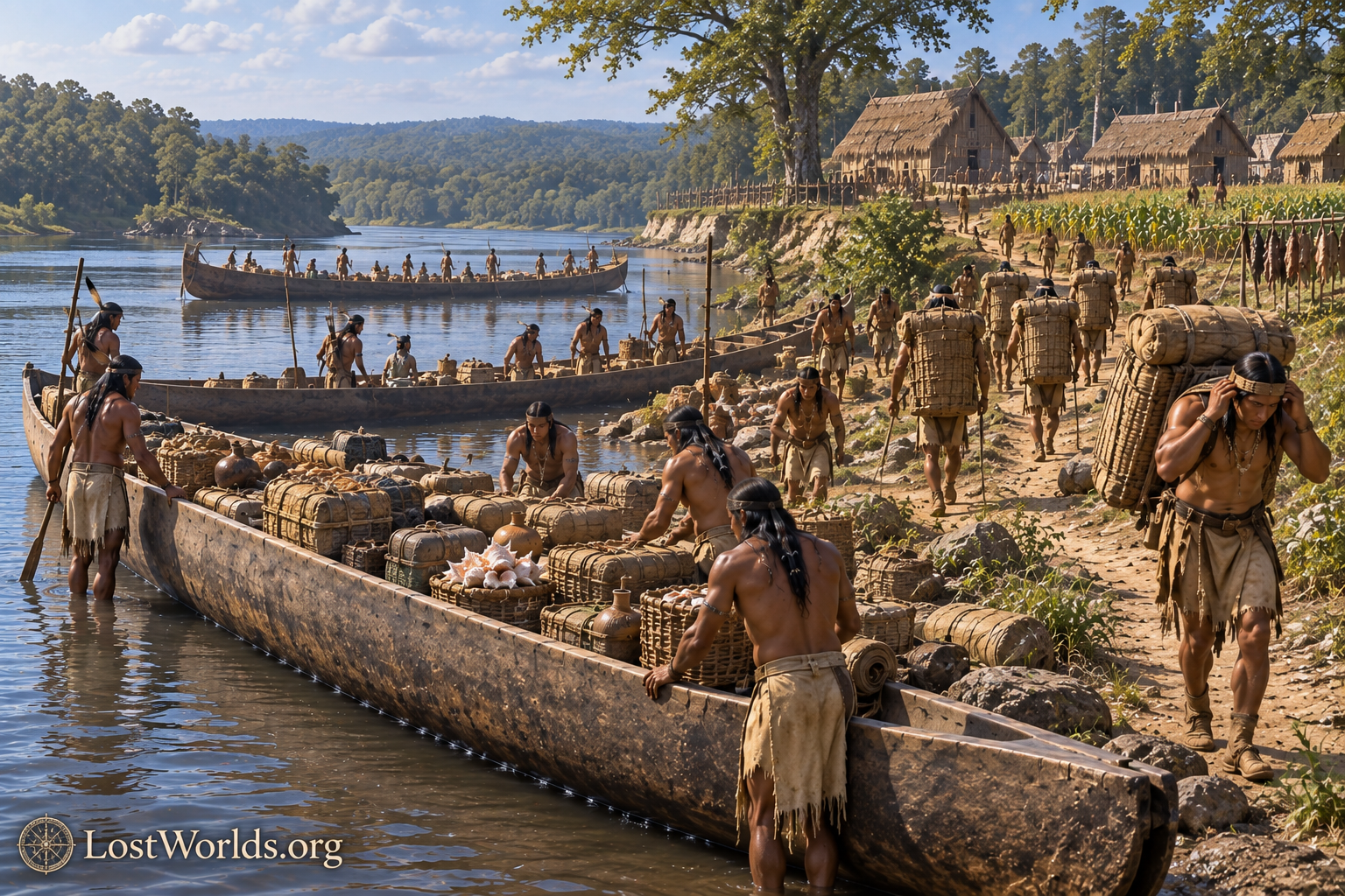
This route places the Nacoochee Valley in a particularly important position. Nacoochee lies not at an isolated mountain terminus but at a gateway between the Georgia Piedmont and the southern Appalachian interior. From this region, Native trails crossed the mountains into the Hiwassee and Little Tennessee drainages, where river travel opened progressively larger transportation systems to the west. The Little Tennessee joined the Tennessee River, and the Tennessee ultimately joined the Ohio–Mississippi system. The route should therefore be understood as a sequence of linked transportation environments rather than a single formally named road: the Savannah River and its fall-line crossing, the Lacoda Trail through the Piedmont, the northeast Georgia mountain gateway, the Appalachian passes, and finally the Little Tennessee and Tennessee river systems.
This physical geography provides the framework of the argument. A trader beginning at the Savannah River could travel inland toward Nacoochee, cross the mountain system through established passages, reach the Little Tennessee watershed, and from there enter one of the great river highways of eastern North America. The distance was substantial, but the route did not require an improbable overland journey across undifferentiated wilderness. It consisted of a succession of known pathways, valleys, river systems, and natural transfer points.
The Archaeological Signature of Long-Distance Exchange
The most important evidence that this corridor functioned as more than a travel route comes from archaeology. The ancient Southeast participated in systems of exchange in which materials traveled hundreds of miles from their geological or ecological sources. Copper, galena, high-quality stone, marine shell, and ceremonial substances moved between communities whose local environments could not have supplied them. These movements establish the economic context within which a specialized merchant population becomes plausible.
Nacoochee provides one of the strongest points of convergence between the archaeological and toponymic evidence for the proposed Sati corridor. The site lies at the mountain end of the documented Lacoda Trail, where movement from the Savannah River and Georgia Piedmont entered the southern Appalachian highlands. Excavations by George Heye, Frederick Hodge, and George Pepper documented a substantial assemblage that included copper objects, galena, mica, hematite, quartz crystals, marine shell, shell drinking vessels, beads fashioned from conch columellae, and other materials whose origins and distribution connect the site with both coastal and continental exchange systems. The coexistence of marine shell with copper, galena, and other nonlocal materials demonstrates that Nacoochee participated in a network extending well beyond its immediate valley.
Nacoochee’s position was even more advantageous than the Savannah–Lacoda connection alone suggests. The valley lies near the upper Chattahoochee drainage, giving it access not only to traffic moving inland from the Savannah River but also to exchange moving north and south through the Chattahoochee system. This broader riverine setting helps explain why such a diverse assemblage of coastal and interior materials converged at Nacoochee. In the present study, however, the Savannah–Lacoda route remains the primary corridor under examination.
The place-name evidence surrounding the mound is equally significant. James Mooney recorded the former Cherokee settlement of Nagu tsi near the junction of the Soquee and Santee rivers in Nacoochee Valley and further stated that the great mound farther up Sautee River was known to the Cherokee as Itsa’ti. (gutenberg.org) These names occur within the same compact mountain landscape rather than at widely separated points. The association is especially
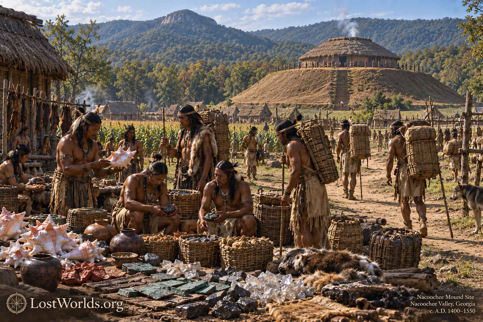
important because Itsa’ti can be compared independently with the historical Dakota forms Isanti, Issati, and the Hidatsa i-tsa-ti, while Santee and Sautee preserve closely related forms within the immediate Nacoochee setting.
The persistence of the Santee name into later cartography strengthens this association. A 1911 Rand McNally map of White County, Georgia, marks a place called Santee just south of Nacoochee, preserving the name as a recognized locality within the same valley system. (mygenealogyhound.com) An earlier regional description also refers to Santee and Dukes Creek Valleys as tributary valleys associated with Nacoochee, showing that the name was part of the local geographic vocabulary before the publication of the 1911 map. (dlg.usg.edu)
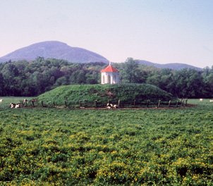
Taken together, the Nacoochee evidence is stronger than a simple resemblance between the modern names Sautee and Sati. The immediate landscape preserves a historically mapped Santee locality, a Santee River, Sautee River, and the Cherokee name Itsa’ti for the mound itself. At the same location, archaeology demonstrates the convergence of marine shell, copper, galena, and other nonlocal materials. The geographic, documentary, linguistic, and archaeological evidence therefore coincide at a single mountain gateway.
This convergence makes Nacoochee one of the strongest candidate nodes in the proposed Sati trade network. If Sati merchants operated as dispersed enclaves rather than as a continuous territorial population, a site such as Nacoochee is precisely where their presence should be most visible: at a major exchange center where coastal and interior goods met, where transportation shifted from Piedmont routes to Appalachian crossings, and where a cluster of Sati-related names persisted long after the ethnic and political landscape had changed.
The same broader pattern is visible farther into the Tennessee Valley. Sites around Chattanooga and the Upper Tennessee drainage contain diverse material traditions reflecting movement and interaction across regions. Citico, Hampton Place on Moccasin Bend, Williams Island, and related settlements occupied locations naturally suited to river travel, crossing, portage, and redistribution. Archaeological syntheses of the region recognize close interaction among the Little Tennessee, Hiwassee, Tennessee, northern Georgia, and wider Mississippian worlds. Rather than representing a series of isolated cultural islands, these settlements belonged to a landscape in which materials and people moved repeatedly between neighboring and distant communities.
The importance of the corridor becomes clearer when the exchange is viewed as reciprocal rather than unidirectional. Interior sources supplied minerals, metals, and superior lithic materials, while the southeastern coast possessed highly valued commodities unavailable in the continental interior. Large marine shells could be transformed into cups, beads, pendants, and gorgets, while coastal botanical resources could be transported inland. A merchant traveling south therefore had potential return cargo rather than simply an empty journey back toward the interior.
Yaupon and the Archaeologically Invisible Trade
One of the most revealing examples of this northbound commerce is the movement of caffeinated Ilex. Chemical analysis of vessels from Cahokia dated between approximately AD 1050 and 1250 identified biomarkers associated with the beverage historically known as Black Drink. The relevant holly species grew far south of Cahokia, demonstrating that a southeastern botanical product had been transported hundreds of miles into the Mississippi Valley. Crown and colleagues characterized the evidence as sustained consumption of a caffeinated beverage made from plants originating in the southern United States.
This finding is important beyond the particular history of Black Drink. Yaupon leaves do not ordinarily survive archaeologically in a form that allows their transportation route to be reconstructed. Their presence at Cahokia became visible only through chemical residues left in ceramic vessels. If modern analytical methods had not detected those residues, a genuine long-distance commodity might have remained almost completely absent from conventional artifact inventories.
Salt presents a similar problem. The coastal and lower-river regions accessible through the Savannah system offered salt resources that would have been economically valuable to inland communities, yet transported salt would normally disappear through consumption. The present paper therefore treats salt as a plausible rather than archaeologically demonstrated commodity within the Savannah corridor. Together with yaupon, it illustrates an important methodological point: the durable artifacts recovered archaeologically probably represent only part of the actual volume and diversity of Native exchange.
The corridor consequently makes economic sense in both directions. Marine products, botanical substances, and potentially salt could move inland from the South Atlantic region, while mineral and lithic materials moved toward Georgia from the continental interior. The movement of these goods does not prove the existence of a Sati merchant organization, but it establishes the commercial problem that such an organization would help explain.
From Nacoochee into the Southern Appalachians
Northwest of the Nacoochee gateway, movement into the interior became constrained by Appalachian topography. Travel across the mountains followed valleys, drainage divides, and passes rather than arbitrary straight lines. This geographic restriction is important because the
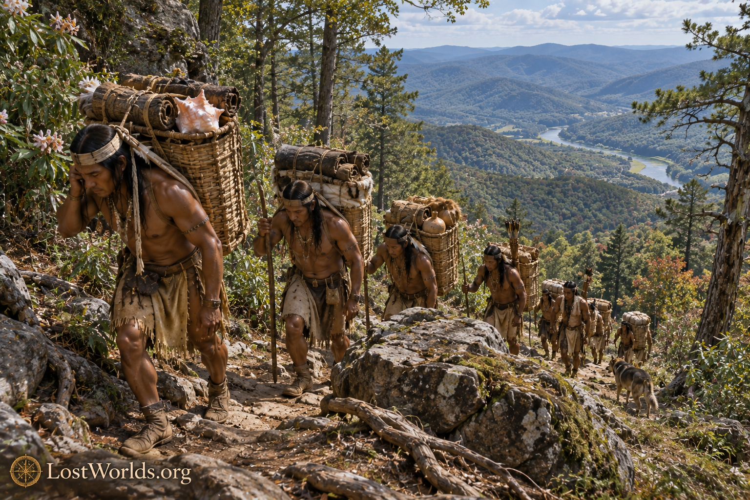
Sati-related place-names examined in this study occur not as a random scatter but within the same broader zone through which such movement had to pass.
Farther into the mountain landscape lies Santeetlah, in western North Carolina. Santeetlah occupies the southern Appalachian region between the Georgia approaches and the Little Tennessee system. Its position does not require the argument that one formal trail ran directly from Sautee through Santeetlah in a perfectly linear chain. Native transportation through mountainous terrain was necessarily a network of related paths. What matters is that Santeetlah lies within the same series of passes and watersheds connecting the northeast Georgia highlands with the Little Tennessee and Tellico country.
On the western side of the mountain system, the route enters the Little Tennessee Valley. Here the number and quality of Sati-related names increase, while river transportation becomes progressively more important. The geographic arrangement is therefore not merely a lexical pattern. It parallels the changing logistics of the route itself.
Satapo, Satico, Settiquo, Itsa’ti, and Citico
The sixteenth-century Spanish record supplies an especially important anchor in the form Satapo. The surviving documentation of Juan Pardo’s expedition preserves Satapo as the name of a Native settlement in the Little Tennessee region.
The Little Tennessee Valley preserves the densest concentration of Sati-related forms yet identified along the corridor. Sixteenth-century records preserve Satapo; eighteenth-century sources record the Overhill town variously as Suitico, Settico, and Settiquo; Mitchell’s 1755 map labels the river itself “Tannassee or Satico R.”; and later usage preserves Citico. These are not names scattered arbitrarily across the Southeast. They occur within the same compact transportation landscape and were recorded by different observers across more than two centuries. The variation is therefore more economically explained as unstable rendering of a related Indigenous name family than as a series of unrelated modern look-alikes.
The same region preserves the historically important Cherokee name Itsa’ti, conventionally represented in English by spellings such as Chota and Echota. The comparison becomes more significant when placed beside historical forms of the Dakota Santee name. The eastern Dakota were known as Isanti, while early French records contain forms such as Issati and Izatys; Warren Upham summarized the relationship by describing the Isanti as “anciently Izatys, now Santees” and noting Issati on Franquelin’s 1688 map.
Washington Matthews supplied an especially important Native-language comparison in his nineteenth-century work on Hidatsa. Matthews recorded a Hidatsa form approximating i tsa’ ti for the Isanti or Santee Dakota. The resulting comparison—Isanti, Issati, i-tsa-ti, and Itsa’ti—is considerably more striking than a comparison based solely on the modern English word Santee. It establishes that a Native rendering closely resembling Itsa’ti was historically used for the Dakota Santee themselves.
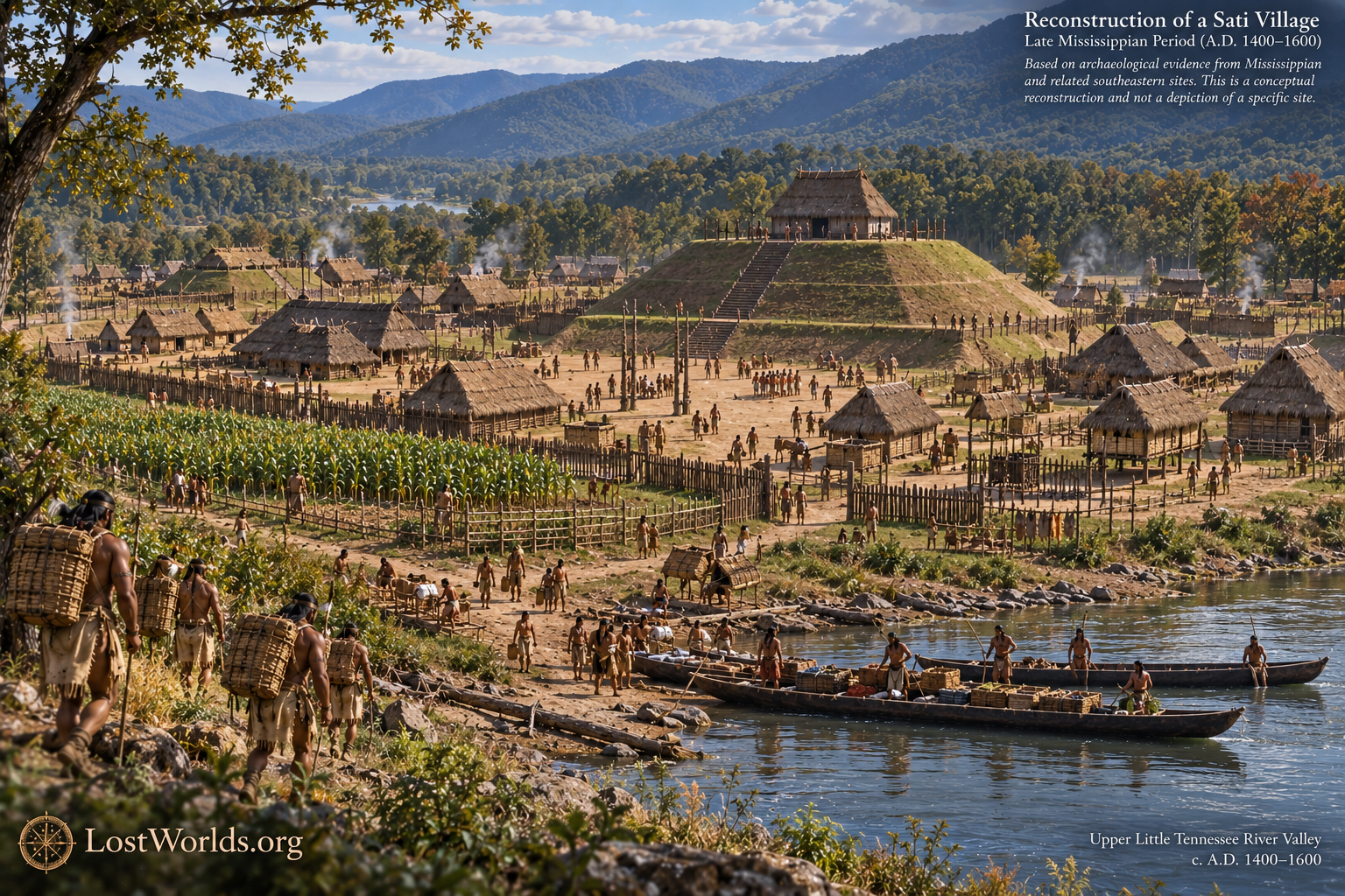
Taken together, the Little Tennessee evidence is stronger than any single place-name considered in isolation. Satapo, Satico, Settiquo, Itsa’ti, and Citico all occur within the same river-and-trail system, while historical spellings demonstrate substantial orthographic instability. The cluster therefore provides one of the strongest geographic and linguistic anchors for the proposed Sati corridor.
AI-Assisted Toponymic Discovery and Mapping
The geographic pattern examined in this study was developed partly through the exploratory use of generative artificial intelligence. AI tools were used to search for additional place-names resembling previously identified Sati/Santee forms, compare spelling variants, and organize those candidate locations spatially. This process was particularly useful because relevant names are distributed across several states and appear in records produced by speakers of different European and Native languages over several centuries.
The use of AI in this research requires an important methodological qualification. Generative systems are capable of producing plausible but nonexistent spellings, citations, etymologies, and historical assertions. Consequently, no AI-generated form was treated as primary evidence. Candidate names identified through AI-assisted searching were checked against historical maps, published primary sources, archaeological reports, and established reference works before being retained. AI therefore functioned as a discovery and mapping aid, not as an authority on linguistic derivation.
This distinction is especially important for toponymic research because large-scale pattern recognition can reveal relationships that are difficult to notice when sources are examined one locality at a time. The contribution of AI was to make the geographic cluster visible and to suggest comparisons for investigation. The evidentiary burden remained with the historical and archaeological record. In practical terms, AI helped ask the question; conventional source criticism determines whether the proposed answer survives examination.
An Orthographic Control Case: Sitilla, Santilla, and Satilla
A useful demonstration of the instability of European transcription is provided by the Georgia river now standardized as Satilla. This river does not belong to the Savannah River–Lacoda corridor examined in the present paper and should not be used as one of its geographic nodes. Its importance here is methodological rather than geographic, because the historical record preserves several forms of the same hydronym.
Period maps and geographical records render the name as Sitilla, Santilla, and Satilla. Because these spellings refer to the same river, they provide a rare control case in which identity does not have to be inferred from similarity: the historical continuity is independently known. The sequence demonstrates that European ears and orthographies could represent one Native name with forms beginning Siti-, Santi-, and Sati-.
This has direct consequences for evaluating the names along the Sati corridor. It does not prove that every southeastern name beginning with Siti-, Citi-, Santi-, Santee-, or Sati- shares a single etymology. It does demonstrate, however, that these forms cannot be treated as categorically different merely because European writers spelled them differently. Where geography, historical continuity, and contextual evidence independently support a relationship, Siti/Citi, Santi/Santee, and Sati may represent alternative attempts to render essentially the same Native sound sequence.
That conclusion permits a more disciplined treatment of Satapo, Citico, Itsa’ti, Sautee, and Santeetlah. Their relevance does not depend on forcing them into a rigid modern spelling pattern. The documented Sitilla–Santilla–Satilla example shows why such rigidity would itself be historically inappropriate.
The Place-Names as a Route Signature
Once the Savannah-to-Tennessee corridor has been established independently, the recurrence of the names acquires greater significance. Sautee occurs at the northeast Georgia gateway reached by the Lacoda Trail. Santeetlah lies within the southern Appalachian crossing zone. Satapo and Itsa’ti occur in the Little Tennessee landscape beyond the mountains, while Citico names persist in the same broader Tennessee transportation system. The names therefore occupy successive environments through which movement from the Savannah River toward the Tennessee would have passed.
This distribution is more consistent with a network than with a territorial state. The names do not enclose a continuous region occupied exclusively by one archaeological culture. Instead, they occur at valleys, towns, waterways, and transportation junctions separated by territories associated with several different Native populations. That pattern is exactly what would be expected if the underlying population consisted partly of mobile traders embedded within larger host communities.
The archaeological record likewise does not require a continuous Santee ceramic horizon. A small trading population operating within established communities could adopt local pottery, architecture, subsistence practices, and kinship connections. Ceramics are especially unlikely to function as a straightforward marker of merchant ethnicity because they are heavy, fragile, and normally manufactured locally. The expected archaeological signature of a dispersed trading population would therefore be mixed assemblages, unusual access to exotic materials, strategic locations, and perhaps persistent place-names rather than a continent-wide foreign pottery type.
This is the central interpretive contribution of the Sati corridor model. The material evidence establishes that long-distance exchange occurred, while the geographic pattern of names offers a possible identification of at least some of the people who facilitated it. The hypothesis does not require the Sati to have monopolized all trade or to have been the sole carriers of every commodity. It proposes instead that they were one durable merchant population within a much larger Indigenous economic system.
The Shawnee Enclave as a Historical Analogue
The historic Shawnee provide a particularly strong comparison because they demonstrate that this social arrangement was possible in the same general region. During the late seventeenth century, Shawnee known to English colonists as the Savannah Indians moved into the Savannah River region near modern Augusta. English-supported Savannah forces defeated the Westo around 1680–81, after which the Shawnee occupied the trade gateway and became deeply involved in the commerce of the region. Archaeological and historical synthesis identifies them as taking control of the slave and deerskin trade previously associated with the Westo. (georgiaencyclopedia.org)
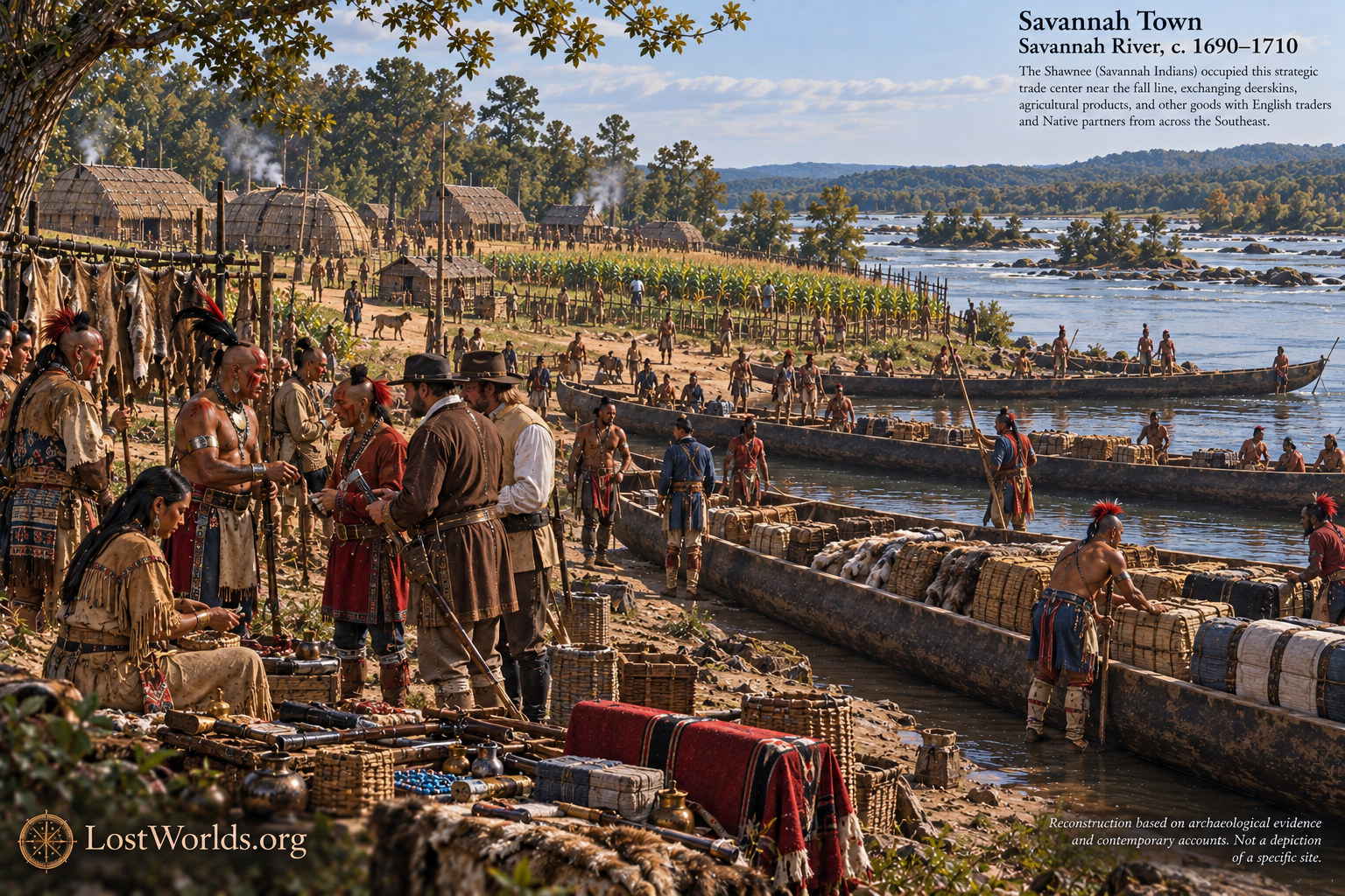
The importance of Savannah Town lies not simply in ethnic analogy but in geography. The Shawnee established themselves near the same Savannah River fall-line region from which the Lacoda Trail led toward the northeast Georgia mountains. They therefore provide a documented example of a mobile Native population occupying the southeastern gateway of the transportation system investigated here. Augusta’s later rise did not create that commercial geography; it succeeded earlier Native and colonial trading centers situated in essentially the same strategic zone. (georgiaencyclopedia.org)
The Shawnee example shows why the absence of a large homogeneous Sati archaeological province would not invalidate the proposed model. The Savannah Shawnee did not need to conquer the surrounding Southeast or replace its local material culture in order to become commercially significant. They occupied a key node and exploited their connections. The Sati hypothesis proposes that an earlier Siouan population may have operated according to a comparable strategy.
The Two Santees
The existence of a historically documented Santee population in South Carolina introduces one of the most important unresolved questions in the argument. Spanish sources from 1609 refer to a town and people called Sati, sometimes rendered Hati, on the Santee River. Swanton regarded these people as the same population subsequently known to the English as the Santee. His treatment of Écija’s account records a chief of Sati and describes routes extending inland from the Santee region. (washacadsci.org)
At the same time, the eastern Dakota of the Upper Midwest were also historically known as Santee, with the better documented earlier forms Isanti, Issati, and Izatys. No source presently identified records the South Carolina Santee specifically as Izatys, Issati, or Itsa’ti. For that reason, the northern Dakota Isanti remain the stronger direct linguistic comparison for the Appalachian Itsa’ti form.
Yet the South Carolina Sati cannot be treated as irrelevant. They represent a second historically documented Siouan population bearing essentially the same ethnonym on the Atlantic side of the broader exchange world investigated in this series. The important question may therefore be less whether the corridor belongs to either the “South Carolina Santee” or the “Dakota Santee” in their later historical forms than whether those populations preserve separated branches of an older Sati distribution.
The present evidence does not justify collapsing the two groups into a single historically documented tribe. Their later languages and political histories were distinct, and the South Carolina Santee language is too poorly documented for the type of direct comparison available for Dakota. The corridor nevertheless raises a legitimate historical question that conventional geographic separation alone cannot resolve: how old was the division between populations carrying the Sati/Santee name, and did long-distance exchange play a role in creating or maintaining that distribution?
Hopewell and the Possibility of a Deep-Time Sati Dispersal
This question is where the Hopewell evidence becomes relevant. It does not belong at the beginning of the argument because Hopewell archaeology does not establish the specific Mississippian Sati corridor. Its importance lies in demonstrating that long-distance exchange between the Midwest and Georgia was already operating during the same broad period in which Siouan populations were undergoing major linguistic differentiation.
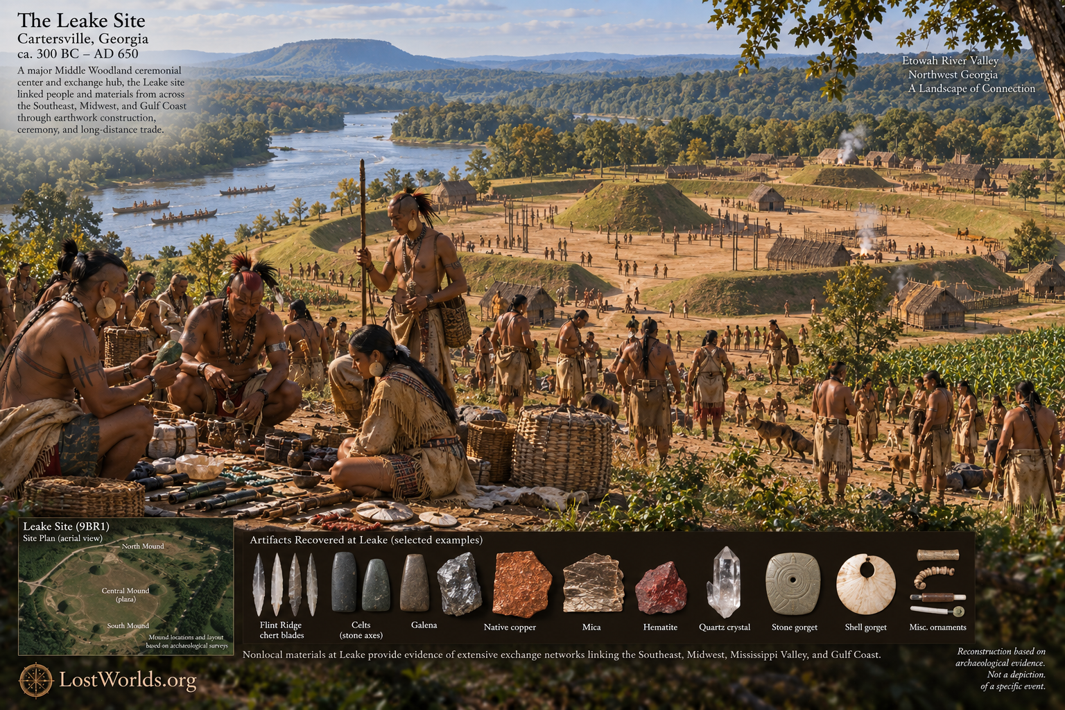
The Leake site near Cartersville, Georgia, provides particularly strong evidence. Dating principally from approximately 300 BC to AD 650, Leake was a major Middle Woodland ceremonial complex with Hopewellian interregional connections. Archaeological investigations recovered Ohio Flint Ridge chert blades, galena, copper, mica, graphite, hematite, quartz crystals, celts, gorgets, and other nonlocal materials. The assemblage demonstrates connections with the Midwest, Tennessee River Valley, Lower Mississippi Valley, Atlantic Coastal Plain, and Gulf Coastal Plain, while petrographic analysis identified a direct ceramic relationship with the Mann site in southwestern Indiana. (archaeology.uga.edu)
This evidence demonstrates that the geographic distances required by the later Sati hypothesis were already being traversed roughly two thousand years ago. It does not prove that the people responsible were Santee, nor does it demonstrate an unbroken commercial institution from Hopewell through Mississippian times. It does, however, make a deep-time dispersal model historically plausible.
One possibility is that ancestral Siouan populations participating in Hopewell-era exchange became geographically separated as communities moved or established themselves along long-distance interaction routes. During the centuries following the decline of the Hopewell Interaction Sphere, those communities could have diverged linguistically and culturally while retaining related ethnonyms. Mississippian economic integration after approximately AD 900–1000 may then have reconnected portions of an older network. In such a model, the South Carolina Sati and Dakota Isanti would not need to represent a recent migration of one directly from the other; they could instead represent eastern and western descendants of an older population whose separation and later commercial relationships unfolded over many centuries.
Other explanations remain possible. The South Carolina Sati may represent a much older eastern Siouan population whose ethnonym only coincidentally resembles Isanti, while Dakota Santee merchants entered the Southeast later. Alternatively, the South Carolina Santee may preserve a remnant of a comparatively recent Mississippian or protohistoric Sati dispersal. The evidence presently supports considering these alternatives rather than selecting one prematurely.
Europeans Enter an Existing Exchange System
By the sixteenth century, the Native commercial world of the southern Appalachians encountered a new source of exotic material: Europe. Spanish expeditions introduced glass beads, bells, iron objects, brass and copper items, and other manufactured goods into Native communities. Archaeological evidence demonstrates that these objects were rapidly incorporated into existing Native contexts rather than producing an entirely separate European economy.
The Tennessee Valley provides particularly useful examples. Hampton Place on Moccasin Bend contains intact burned houses associated with extensive quantities of sixteenth-century Spanish material, while Williams Island likewise produced Spanish contact materials from house contexts. Radiocarbon determinations from charred structural posts place these occupations squarely within the sixteenth-century contact period. (npgallery.nps.gov) Archaeological syntheses also identify Spanish artifacts at Citico and several neighboring Tennessee and northwest Georgia sites, demonstrating that European objects entered a preexisting network of interconnected Native communities. (archaeology.uga.edu)
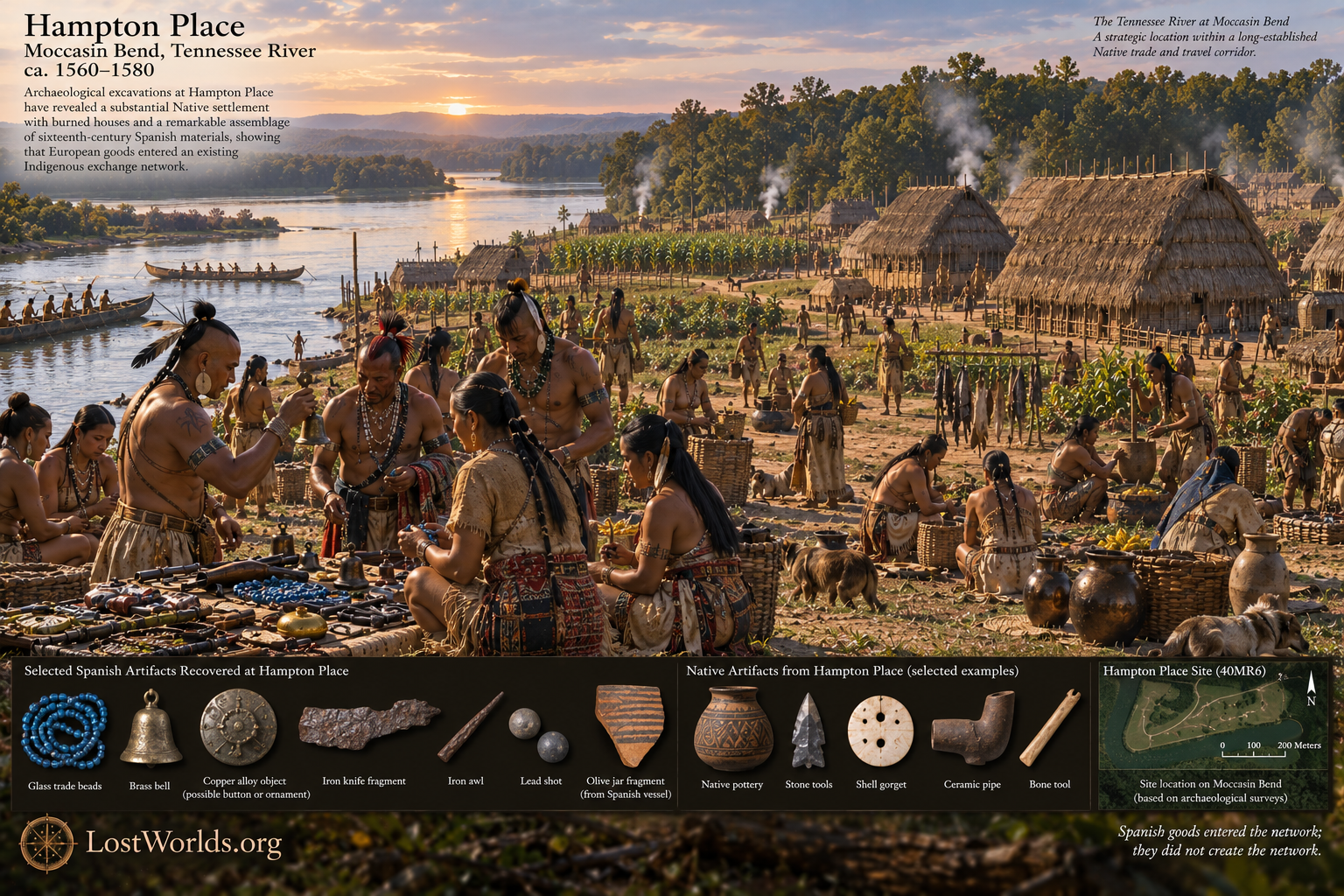
The significance of these finds for the Sati corridor is limited but important. They are not evidence that Spaniards created or operated the earlier trade route. Rather, they demonstrate that Native exchange systems were capable of absorbing a new overseas source of exotic commodities. Some Spanish objects undoubtedly passed directly from expedition members to Native recipients, while others could subsequently move through Native redistribution beyond the physical route traveled by Spaniards.
By the time English commerce expanded into the Southeast, Native communities therefore had generations of experience incorporating European goods into their own systems of exchange. More fundamentally, they had centuries—indeed millennia—of experience dealing with distant peoples and foreign commodities. European trade entered an established Native economic landscape rather than creating long-distance exchange for the first time.
The English at Savannah and Augusta
The English eventually entered the Savannah River system in precisely the geography that had made the corridor valuable in the first place. By the late seventeenth century, trade in European manufactured goods, deerskins, and Native captives had already transformed the political economy of the Savannah. Westo power near Augusta depended heavily upon access to English firearms and other manufactured commodities, and the Shawnee who displaced them subsequently assumed an important position within the regional trade. (georgiaencyclopedia.org)
Savannah Town became a recognized trading center near the Savannah River fall line. When Augusta was founded nearby in 1736, it inherited rather than invented this commercial role. The New Georgia Encyclopedia notes that Carolina traders operating through Savannah Town carried goods toward distant Muscogee and Choctaw communities and that Augusta was subsequently established as a major inland trading center. (georgiaencyclopedia.org)
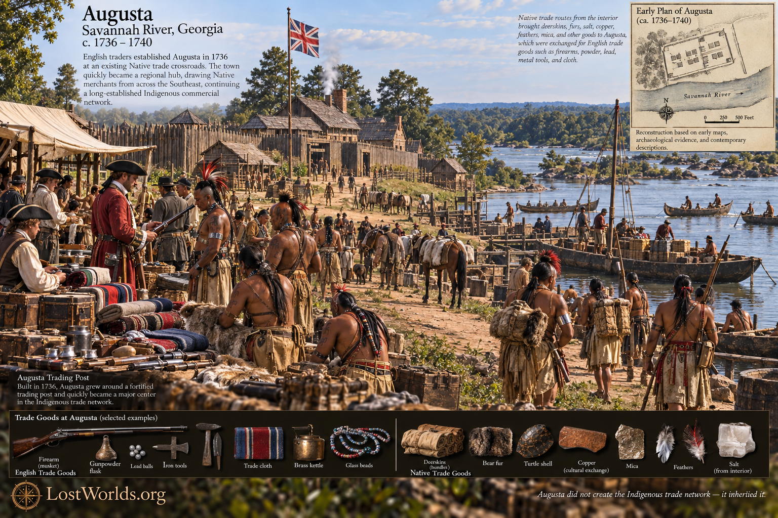
Mitchell’s 1755 map provides a particularly clear illustration of how far English commerce had already penetrated this Indigenous transportation network. In the Overhill Cherokee country, west of Chota and along the same Little Tennessee–Tellico system discussed above, Mitchell labels “Gr. Telliquo an English Factor.” In eighteenth-century commercial usage, a factor was a trading agent or representative, indicating that an English trader was established at Great Tellico deep within the Appalachian interior. The significance of this notation is not that the English created the route to Tellico, but that they had inserted themselves into a preexisting Native commercial landscape extending far beyond the coastal settlements. By the mid-eighteenth century, English trade was therefore operating not only from Savannah and Augusta but within the very mountain-and-river system through which Native exchange had long moved.
Seen against the much longer history reconstructed in this paper, the first English traders represented another addition to a familiar pattern. They occupied strategic points, brought desirable exotic goods, relied upon Native roads and Native political relationships, and distributed their commodities through existing networks. Native societies did not need Europeans to teach them long-distance commerce; they incorporated the newcomers into systems of exchange that greatly predated colonial settlement.
The eventual difference was political rather than commercial. The Sati merchant model proposed here does not envision traders arriving with a demographic apparatus capable of replacing the societies among whom they traded. The Savannah Shawnee likewise established an enclave without converting the Southeast into a Shawnee settler state. The English trading presence, however, was connected to Atlantic ports, imperial institutions, military power, and an expanding settler population. What began as participation in Native commerce could therefore become territorial occupation.
This distinction helps place the colonial transformation in a longer perspective. Savannah and Augusta initially succeeded because they entered an existing commercial geography. In subsequent generations, the same trails and river gateways that had carried Native trade became avenues for colonial settlement and land acquisition. The infrastructure remained recognizable even as the political purpose of those using it changed.
Conclusion
The principal finding of this paper is not simply that similar Native place-names occur in Georgia, North Carolina, and Tennessee. It is that those names occur within a transportation landscape independently demonstrated by historical geography and archaeology. The Lacoda Trail linked the Savannah River near Augusta with Tallulah and Nacoochee; the northeast Georgia mountains opened onto established crossings toward the Little Tennessee system; and the Little Tennessee connected directly with the Tennessee and Mississippi river networks. Along this broad route, archaeological sites contain materials whose sources lie hundreds of miles apart.
Nacoochee contained marine conch, copper objects, galena, mica, and other nonlocal materials. The Mississippi interior received southeastern Ilex, proving the movement of an archaeologically elusive botanical commodity over great distances. The Tennessee Valley contained interconnected communities whose material assemblages reflect continuing movement across regional boundaries. These facts establish the commercial environment before any attempt is made to identify the merchants.
Against that independently established background, the place-names become more significant. Sautee, Santee, and Itsa’ti occur at the Georgia mountain gateway. Santeetlah occurs within the southern Appalachian crossing region. Satapo, Satico, Settiquo, Itsa’ti, and Citico occur in the Little Tennessee landscape, while Citico persists within the same broader Tennessee transportation world. The historical Dakota Santee provide the independently documented sequence Isanti–Issati–Izatys–Santee, together with the Hidatsa rendering i-tsa-ti, while Spanish sources identify a separate South Carolina population as Sati which later was rendered Santee. The names therefore behave less like the boundaries of a single territorial nation than like the surviving traces of populations associated with movement through a network.
The documented Sitilla–Santilla–Satilla sequence strengthens this interpretation in a specific and limited way. The Satilla River itself is outside the Savannah River corridor examined here and belongs to a separate geographic problem. Its value in the present study is that the same hydronym is historically documented under Siti-, Santi-, and Sati- spellings. It therefore demonstrates that European orthography could make forms that appear distinct on a modern map represent one and the same Native name. Consequently, Siti/Citi, Santi/Santee, and Sati forms along the corridor cannot be rejected as unrelated merely because their standardized spellings differ.
The trade-enclave model offers a mechanism capable of explaining the resulting pattern. A merchant population did not need to conquer the lands separating its commercial communities. Traders could reside among larger host populations, use locally manufactured ceramics, establish kinship relationships, and leave little archaeologically distinctive domestic culture. Their continued access to distant goods would be the source of their importance, while their names might survive at strategic nodes long after the communities themselves had been absorbed or displaced.
The Savannah Shawnee demonstrate historically that such mobility was possible. Their settlement near Augusta occupied the same strategic Savannah River gateway from which the Lacoda Trail led into the Georgia interior. The Shawnee therefore provide not merely an abstract ethnographic analogy but a documented later example of a mobile Native population establishing commercial importance at a major node within this transportation landscape.
The relationship between the Dakota Isanti and South Carolina Sati remains unresolved, but that uncertainty opens rather than closes an important historical problem. Hopewell archaeology demonstrates that Georgia was already connected to the Midwest, Tennessee Valley, Mississippi Valley, and coastal regions approximately two thousand years ago. If major Siouan population differentiation was occurring during the same broad period, then the separation of eastern and western Sati populations may have roots in a much older era of continental interaction. Alternatively, later Mississippian commerce may have reconnected populations whose linguistic divergence had begun centuries earlier.
Finally, European contact did not create the system described here. Spanish artifacts entered Native communities along the Appalachian and Tennessee networks during the sixteenth century, showing how readily an existing Indigenous exchange economy could absorb a new category of foreign commodities. The English later entered the same commercial world through the Savannah River, Savannah Town, and Augusta. For a time they functioned as another set of outside traders operating through established Native infrastructure. Only later did the nature of that relationship change as commerce became inseparable from colonial settlement and territorial expansion.
The cumulative argument of the present study is therefore stronger than a linguistic resemblance alone. Archaeology establishes long-distance exchange. Historical geography establishes a viable Savannah-to-Tennessee transportation corridor. The enclave model explains how a mobile population could operate across territories dominated by other societies. The surviving Sati/Santee-related names repeatedly occupy the strategic geography of that corridor.
The artifacts demonstrate the trade, the landscape reveals the route, and the place-names identify the Sati/Santee as a serious candidate for the merchants who helped connect its distant ends.
References
Crown, Patricia L., Thomas E. Emerson, Jiyan Gu, W. Jeffrey Hurst, Timothy R. Pauketat, and Timothy Ward. 2012. “Ritual Black Drink Consumption at Cahokia.” Proceedings of the National Academy of Sciences 109(35): 13944–13949. (experts.illinois.edu)
Dubcovsky, Alejandra. 2011. Connected Worlds: Communication Networks in the Colonial Southeast, 1513–1740. Ph.D. dissertation, University of California, Berkeley.
DePratter, Chester B., Charles M. Hudson, and Marvin T. Smith. 1983. “The Route of Juan Pardo’s Explorations in the Interior Southeast, 1566–1568.” Florida Historical Quarterly 62(2): 125–158.
Heye, George G., Frederick W. Hodge, and George H. Pepper. 1918. The Nacoochee Mound in Georgia. New York: Museum of the American Indian, Heye Foundation. (dlg.usg.edu)
Hudson, Charles M. 1990. The Juan Pardo Expeditions: Explorations of the Carolinas and Tennessee, 1566–1568. Washington, D.C.: Smithsonian Institution Press.
Matthews, Washington. 1877. Grammar and Dictionary of the Language of the Hidatsa. Washington, D.C.: Government Printing Office.
Mitchell, John. 1755. A Map of the British and French Dominions in North America, with the Roads, Distances, Limits, and Extent of the Settlements. London: Andrew Millar. Library of Congress, Geography and Map Division.
Mooney, James. 1894. The Siouan Tribes of the East. Bureau of American Ethnology Bulletin 22.
Mooney, James. 1900. Myths of the Cherokee. Nineteenth Annual Report of the Bureau of American Ethnology.
Rand McNally and Company. 1911. White County, Georgia. County map. Chicago: Rand McNally and Company.
Rothrock, Mary U. 1929. “Carolina Traders Among the Overhill Cherokees, 1690–1760.” The East Tennessee Historical Society Publications 1: 3–18.
Smith, Marvin T. 1987. Archaeology of Aboriginal Culture Change in the Interior Southeast: Depopulation During the Early Historic Period. Gainesville: University Press of Florida.
Stone, Ross Conway. 1878. The Gold Mines, Scenery and Climate of Georgia and the Carolinas. New York: National Bank Note Company.
Swanton, John R. 1922. Early History of the Creek Indians and Their Neighbors. Bureau of American Ethnology Bulletin 73. (repository.si.edu)
Upham, Warren. 1920. Minnesota Geographic Names: Their Origin and Historic Significance. St. Paul: Minnesota Historical Society. (genealogytrails.com)
Wilson, G. J. N. 1914. The Early History of Jackson County, Georgia. Jefferson, Georgia. (dlg.usg.edu)
University of Georgia Laboratory of Archaeology. Archaeological Data Recovery at the Leake Site, Bartow County, Georgia. (archaeology.uga.edu)