Reconsidering Altamaha
A Source Audit of Tama and a Possible Siouan Etymology
The Altamaha is one of Georgia’s great rivers, formed where the Oconee and Ocmulgee meet before flowing eastward across the Coastal Plain to the Atlantic. Yet the name Altamaha did not begin as the name of that river.
Its earliest documentary appearances belong instead to an Indigenous town, province, or political community in the interior of Georgia. The records preserve a striking sequence of forms – Altapaha, Altamaca, Altamaha, Tama, Olatama, and eventually Tamali. Swanton summarized the earliest variants as Biedma’s “Province of Altapaha” and Elvas’s “town of Altamaca,” while Ranjel preserved Altamaha (Swanton 1922, 95).
Placed in chronological order, those forms suggest an important possibility that is not itself claimed by Swanton or any other source: Tama appears to be the most stable element in the changing name. That observation becomes especially interesting because the people later associated with Tamali belonged to the Hitchiti-speaking world. It is therefore tempting to assume that the older name must also have originated in Hitchiti. But the language spoken at sixteenth-century Tama was never recorded.
A particularly intriguing comparison emerges from Siouan. The Comparative Siouan Dictionary records Kanza/Kaw ttáma, “town,” and describes the wider settlement term as “widely diffused … in and outside of Siouan” (Rankin et al. 2015, “town (1)”). Choctaw also preserves támaha, “town,” but the comparison becomes more complicated when the term is placed alongside the ordinary words for “town” in the other Muskogean languages.
None of this proves what Georgia Tama meant. It does, however, reopen a question that has generally been treated as settled too quickly: whether the name Tama may be older than the later Hitchiti-speaking communities associated with it.
Altamaha Before the Altamaha River
The earliest surviving forms come from Hernando de Soto’s 1540 expedition through Georgia. The Gentleman of Elvas is explicit about what Altamaca represented:
“The fourth of April the Governor passed by a town called Altamaca” (Gentleman of Elvas 1557; trans. in French 1850, 139).
This is important. The earliest surviving narrative does not introduce Altamaca as the name of a river. It is a town.
The other expedition traditions preserve slightly different forms. As Swanton noted, Biedma called it the “Province of Altapaha,” while Ranjel used Altamaha (Swanton 1922, 95). The chroniclers therefore do not give us one perfectly fixed spelling. What they do give us is a cluster of closely related names applied to the same political landscape.
Ranjel’s account also places Altamaha within the orbit of Ocute and records that its chief supplied food and helped transport the Spaniards across a river. Swanton interpreted the account as suggesting that Altamaha was subordinate to the more powerful chief of Ocute (Swanton 1922, 95).
The archaeological and geographic placement is less certain than the documentary name itself. Worth argued that the Tama/Ocute landscape was centered on the Oconee Valley. By the beginning of the seventeenth century he considered the evidence consistent with Tama lying near the Fall Line, probably in the vicinity of the Shinholser site, while emphasizing that the archaeological evidence remained limited (Worth 1993, 40-43; Worth 1994, 108-110).
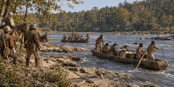
That location matters. A settlement near the Fall Line would occupy the transition between navigable Coastal Plain waterways and the shoals and higher terrain upstream. Canoe routes, overland trails, portage, political authority, and exchange could converge there. The documentary trail therefore begins not with a named coastal river, but with an Indigenous political name located at a strategically important interior crossing.
Then the Name Becomes Tama
When Spaniards returned to the Georgia interior late in the sixteenth century, the shorter form Tama became common. Gaspar de Salas visited the town in 1596, and Governor Gonzalo Méndez de Canço repeatedly referred to Tama in his plans for the interior. Swanton records Méndez de Canço’s 1598 reference to a place “which is called Tama” (Swanton 1922, 181).
The title of the formal inquiry begun in St. Augustine in February 1600 is even more revealing:
Relación de la Tama y su tierra, y de la población de ingleses
(Méndez de Canço 1600; Serrano y Sanz 1912, 141-159; Birkhofer and Worley 2025, 47-62).
The Spanish wording matters. La is the feminine definite article: de la Tama – “of the Tama.” Whatever grammatical convention led Spanish speakers to use the article, the lexical name appearing after it is Tama.
This is not an isolated spelling appearing centuries later. It is the form Spanish officials were using for the interior province at the turn of the seventeenth century.
Olatama: The Missing Link
Juan de Lara’s expedition of 1602 provides perhaps the most revealing evidence in the entire sequence.
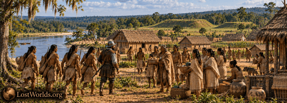
Lara testified that after traveling inland for about nine days, “He arrived at a sierra and at a town which is called Olatama” (Lara 1602, trans. Worth 1994, 109). He then identified that settlement as the capital of the province. Yet Governor Méndez de Canço, describing Lara’s very same expedition, wrote that he had sent him “to the said Tama” (Méndez de Canço 1602, trans. Worth 1994, 109) (Worth 1994, 109).
These are not names separated by several generations, different colonial administrations, or distant regions. Olatama and Tama were being used for the same destination at essentially the same moment.
Al-TAMA-ha
Al-TAMA-ca
TAMA
Ola-TAMA
The surrounding sounds change. Tama remains.
That is our observation. Worth does not argue that these names should be segmented in this fashion, nor does Lara tell us that Tama is a detachable morpheme. But when the documented forms are placed side by side, Tama is plainly the element that survives across them. It is therefore reasonable to investigate it separately.
Olatama: A Possible “Tama Town”?
Lara’s Olatama may provide another clue.
Albert Gatschet’s comparative Muskogean vocabulary gives the following ordinary equivalents under “Village, town”: Choctaw támaha, Chickasaw ókla, Alabama óla, Koasati óla, Creek tálofa, Hitchiti ókli, and Mikasuki ókli (Gatschet 1884, 56).
That creates an intriguing structural possibility:
Ola + Tama -> Olatama
“town + Tama” -> “Tama town”?
This is our proposed analysis, not Lara’s translation and not Gatschet’s. Nothing in Lara’s testimony identifies the language from which he heard Olatama. We therefore cannot claim that Olatama literally meant “Tama town.”
But the construction is linguistically plausible enough to matter. Alabama and Koasati provide a documented óla “town,” while Tama was independently being used for this same settlement. The possibility should therefore remain open that an already existing proper name, Tama, was being incorporated into another linguistic system.
Another name in the same landscape reinforces the broader point. Fray Pedro de Chozas’s 1597 expedition passed through Tama and then through places called Quaque, Talufa, and Usatipa. Worth concluded that Talufa was probably related to the earlier Patofa and wrote that “Usatipa may also have been a subordinate Oconee Valley cacique in 1597” (Worth 1993, 42).
Gatschet’s comparative table independently records Creek tálofa as “village, town” (Gatschet 1884, 56). Whether the historical Talufa can simply be translated by that common noun is another question. The point is narrower: recognizable Muskogean settlement terminology was operating in the same broader region in which the older name Tama persisted.
Tama at the River Crossing
The geography strengthens the historical importance of the name without determining its linguistic origin.
Worth’s reconstruction places Tama in the Oconee Valley near the Fall Line. His 1993 review says that between 1597 and 1628 several Spanish expeditions reached a Tama “possibly still centered at the Shinholser site at the Fall Line” (Worth 1993, 41). Lara’s 1602 journey independently describes reaching a sierra, Olatama, and a “copious and large” river after the long inland journey (Worth 1994, 109).
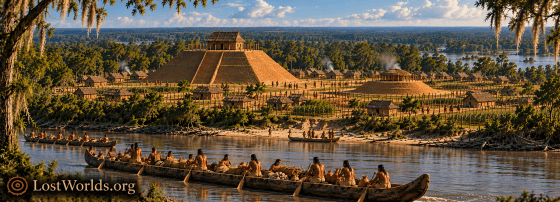
This was therefore not simply an arbitrary inland village. The earlier Altamaha was associated with a major river crossing, and the later Tama/Olatama remained in essentially the same Oconee transportation landscape.
That becomes significant when compared with other places examined in this series. Ocmulgee occupied the corresponding Fall Line position on the neighboring Ocmulgee River and our research suggested it was once known as Echetee/Itsa’ti. Augusta occupied the Savannah Fall Line gateway from which the Lacoda Trail led into the southern Appalachians to our Itsati/Sati corridor at Sautee-Nacoochee. The Satilla formed another Atlantic-interior corridor farther south. Tama belongs geographically to the same class of strategic location: a place where river traffic and interior trails could meet.
What Happened to Tama?
The seventeenth century transformed interior Georgia. Warfare, disease, slave raiding, colonial expansion, and migration broke apart older political systems. Worth found that the original interior province of Tama disappears from the documentation after the mid-seventeenth century; by 1675, however, the name Tama was appearing among Native settlements in both Mocama and Apalachee (Worth 1993, 44-45).
The name therefore survived the disruption of the original polity and reappeared in two separate linguistic families— Timucuan and Muskogean.
Later records preserve Tamali and related forms. Swanton explicitly connected Tamali with the earlier Tama and, while discussing an earlier Toalli form, proposed that its ending represented “presumably the Hitchiti plural -ali” (Swanton 1922, 181).
That suggests a different direction of development from the one that might initially be assumed:
Tama + Hitchiti -ali -> Tamali
Again, that equation is our reconstruction. Swanton supplied the historical connection between Tama and Tamali and identified a Hitchiti -ali element; he did not use that evidence to argue that Tama itself came from another language. But this now adds a third linguistic family, Hitchiti, that preserved the name Tama.
If the analysis is correct, Hitchiti may explain the later morphology without explaining the older root.
That possibility resembles the model proposed in the Satilla source audit. An inherited place-name can survive while later speakers reshape it according to their own phonology or morphology. The resulting form may look thoroughly at home in the later language even when the underlying name predates the people who inherited it.
Cherokee provides a useful documented warning against equating later occupation with original etymology. Mooney recorded I’tawa’ – Etowah – and wrote that the name “cannot be translated and seems not to be of Cherokee origin” (Mooney 1900 [1902], s.v. I’tawa’). He likewise recorded Itsa’ti – Echota/Chota – and stated simply that “the meaning is lost.”
A community can inherit a name without having coined it.
A Possible Siouan Parallel
If Tama is the stable core preserved in Altamaha, Olatama, and later Tamali, its original meaning remains unknown. No sixteenth-century source translates the name, and no vocabulary survives from the people encountered there that would identify their language directly.
There is, however, a striking Siouan comparison.
The Comparative Siouan Dictionary records:
Kanza/Kaw: ttáma – “town”
The same entry reconstructs a broader Mississippi Valley Siouan settlement term and cautions that it appears to have been “widely diffused … in and outside of Siouan” (Rankin et al. 2015, “town (1)”).
Georgia historical name: Tama
Kanza/Kaw Siouan: ttáma – “town”
The resemblance does not establish that Georgia Tama meant “town,” and it does not prove that the inhabitants of Tama spoke a Siouan language. But it demonstrates something considerably more concrete than a speculative sound resemblance: an essentially identical form carrying an appropriate settlement meaning is documented in a Siouan language.
That comparison deserves to be considered rather than excluded simply because later Tamali communities were Hitchiti-associated. The fact Tama appears in both Timucuan and Muskogean speaking communities further illustrates the point.
Choctaw Tamaha: A Muskogean Outlier
There is also a Muskogean comparison that cannot be ignored. Choctaw támaha means “town.”
If Choctaw were considered in isolation, támaha might appear to provide a straightforward Muskogean explanation for Georgia Tama. Gatschet’s comparative vocabulary makes the situation much less simple. Under the single heading “Village, town,” he gives Choctaw támaha, but Chickasaw ókla, Alabama and Koasati óla, Creek and Seminole tálofa, and Hitchiti and Mikasuki ókli (Gatschet 1884, 56).
Thus támaha is not the ordinary family-wide Muskogean word for “town.” Even Chickasaw, Choctaw’s closest relative, uses a different term in Gatschet’s table.
This is where the Comparative Siouan Dictionary becomes particularly important. Its editors do not treat the broader tama/tamaha complex as confined to Siouan. They explicitly note lookalikes in several eastern North American language families, including Choctaw and Mobilian, while characterizing the term as widely diffused (Rankin et al. 2015).
That makes borrowing or regional diffusion a legitimate possibility. It does not establish the direction of transmission. The word could have passed from Siouan into Choctaw, from some other language into both, or circulated within a larger multilingual interaction sphere.
Nor has the evidence located here established that Choctaw tamaha can be securely broken into an earlier tama plus a meaningful -ha. The lexical sources treat támaha as the word. Until a Choctaw morphological source demonstrates otherwise, splitting it merely to produce a closer match with Georgia Tama would be unjustified.
What Does Hitchiti Tell Us?
The later historical association of Tamali with Hitchiti-speaking communities remains important. It tells us something about the people who eventually carried the name.
It does not automatically translate the older name Tama.
Gatschet’s comparative table gives Hitchiti ókli for “town” (Gatschet 1884, 56), and elsewhere he is explicit that “úkli” means town in Hitchiti (Gatschet 1884, 144).
Therefore, if the Tama ~ ttáma ~ tamaha comparison concerns a word meaning “town,” ordinary Hitchiti vocabulary does not provide that same match.
Hitchiti may instead explain something different: the later -ali morphology identified by Swanton.
That distinction is central. The later Tamali can be historically Hitchiti-associated without requiring the older Tama to have originated in Hitchiti.
Which Tradition Records the “Town” Word First?
The documentary chronology does not settle the direction of linguistic borrowing.
Georgia’s Altamaca/Altamaha appears in the written record in 1540, and Tama is securely documented by the late sixteenth century. But none of those sources translates the name. Consequently, their early date cannot establish that Tama already meant “town.”
Choctaw tamaha appears as a translated settlement term in European documentation before the Kanza/Kaw form was recorded by modern linguists. That fact is worth acknowledging, but written priority is not linguistic priority. Europeans documented different Native languages at radically different times and with radically different intensity.
A word could have circulated orally for centuries before anyone wrote it down.
The historical documents therefore leave the direction of diffusion unresolved.
A Mississippian Trade Vocabulary?
The possibility of diffusion is particularly interesting in the Mississippian Southeast, where copper, marine shell, stone, pigments, ceremonial objects, foodstuffs, people, and ideas moved across enormous distances.
Such exchange did not require one ethnic or linguistic population to control an entire route. Merchants, families, diplomats, ritual specialists, migrants, captives, and small enclaves could move through communities speaking entirely different languages.
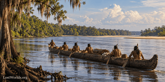
If a settlement term circulated through such networks, “town” would be an obvious candidate. Travelers repeatedly needed to identify settlements, destinations, and political communities.
The linguistic sources do not tell us that Siouan merchants introduced tama into a Mississippian trade vocabulary. That is our hypothesis. What the linguistic evidence does establish is that a very similar settlement word occurs across language-family boundaries and that the Comparative Siouan Dictionary itself regards the form as widely diffused.
Tama’s position at a major Oconee crossing makes that possibility considerably more interesting.
Another Name Nearby: Usatipa
The 1597 Chozas expedition adds a second intriguing name to the same landscape. Fray Escobedo’s account names Quaque, Talufa, and Usatipa beyond Tama. Worth concluded that Usatipa may have been another subordinate Oconee Valley political community (Worth 1993, 42).
Visually, the name contains a familiar sequence:
U-SATI-pa
That is an observation, not an etymology.
Neither the initial U- nor the final -pa has yet been demonstrated to be detachable, and we do not know what language produced Usatipa. The name cannot therefore be turned into evidence for a Sati presence merely by dividing it into convenient pieces.
Its importance comes from context. Previous work in this series has traced Sati/Itsati-type names through the Savannah corridor, the southern Appalachians, the Ocmulgee landscape, and the Satilla basin. Spanish documents preserve Sati for the South Carolina Santee, while northern sources preserve Issati/Izatys/Isanti-type forms among the eastern Dakota. Cherokee geography preserves Itsa’ti, Sautee, and related forms.
Usatipa now appears beside Tama in the Oconee Valley.
By itself, that proves nothing linguistic. In combination with the surrounding geography, however, it gives us another reason to investigate the Oconee as part of the same larger transportation landscape.
Then There Is Etowah
A second Georgia settlement name raises an even more provocative comparison.

James Mooney recorded the Cherokee name of Etowah as I’tawa’. He noted early forms including Itaba, Ytaua, and Ytava and stated that the Cherokee name “cannot be translated and seems not to be of Cherokee origin” (Mooney 1900 [1902], s.v. I’tawa’).
The Comparative Siouan Dictionary reconstructs a Mississippi Valley Siouan form approximately *htáw?, “town,” with related forms across several Siouan languages (Rankin et al. 2015).
The comparison is therefore:
Tama <-> Kanza/Kaw ttáma – “town”
Itawa/Ytaua <-> Siouan *htáw? – “town”
Neither equation is a demonstrated etymology.
Etowah in particular has a competing Muskogean comparison involving italwa/italua, “town” or “community.” The name therefore cannot simply be declared Siouan on phonetic resemblance.
The archaeological context nevertheless makes the comparison worth revisiting. Sullivan and colleagues modeled population movement from the Central Mississippi Valley into the Middle Cumberland region and then into the Ridge-and-Valley regions of eastern Tennessee and northern Georgia between roughly AD 1200 and 1450. Their study specifically investigates movement into “the Great Valley of East Tennessee and northern Georgia” (Sullivan et al. 2024).
Adam King has independently argued that some of the foreign material at Etowah came with elite families from Cahokia and, thus, is better explained by migration than exchange, concluding that the objects “came with people rather than through exchange” (King 2020, 352-366).
Neither archaeological study identifies those migrants as Siouan. What they establish is the mechanism that an inherited-name hypothesis requires: real movement of people into northern Georgia from regions tied to the central Mississippi world where Siouan was a known linguistic family.
Ocmulgee: Another Southern Branch?
The same northern Georgia-eastern Tennessee connection becomes relevant again at Ocmulgee.

The Macon Plateau settlement has long stood apart archaeologically from surrounding central Georgia communities. Thompson and colleagues note that its ceramic assemblage was sufficiently unusual that migration became a classic explanation for the site. They summarize Mark Williams’s model as an in-migration “likely from the area of northwestern Georgia or eastern Tennessee” (Thompson et al. 2026).
The new radiocarbon program strengthens the chronological plausibility of that interpretation. The Earthlodge roof-beam model produced “a felling date sometime after cal AD 1155-1165” (Thompson et al. 2026). The authors conclude that this later chronology places Ocmulgee more closely in line with developments in eastern Tennessee and northwest Georgia and “lends more support to migration explanations” (Thompson et al. 2026).
Again, none of this identifies the migrants as Sati or Siouan.
What it does establish is movement from precisely the northern region in which the Itsa’ti/Citico place-name complex becomes relevant to this series. Ocmulgee then occupies the Fall Line gateway of the Ocmulgee River, immediately west of Tama’s Oconee corridor, and it possibly was known as Echetee/Itsa’ti before the Ocmulgee designation.
The geography begins to look less like one straight trade route and more like a network of parallel river-and-trail corridors.
Two Georgia “Town” Names?
Seen in that context, two old Georgia settlement names deserve comparison with Siouan settlement vocabulary:
Tama <-> Kanza/Kaw ttáma – “town”
Itawa/Ytaua <-> Siouan *htáw? – “town”
The linguistic sources establish the Siouan forms and meanings. They do not identify Georgia Tama or Etowah as Siouan names.
Both Georgia names have possible Muskogean comparisons. Neither comes with a sixteenth-century Indigenous translation identifying its original meaning. Neither can establish the ethnicity of the people occupying the site.
The significance is cumulative rather than conclusive. Both names occur at major Mississippian centers or transportation gateways. Both survived among populations historically identified with other languages. Both existed within landscapes for which archaeology now demonstrates substantial long-distance movement.
Perhaps such names did not identify the ethnic majority of a settlement at all. Perhaps some preserved terminology circulating through the networks connecting those settlements.
That remains a hypothesis.
A Name Can Outlive a People
This may be the most important lesson of the Altamaha sequence.
Historically documented Native identities understandably became the framework through which earlier place-names were interpreted. If later Tamali communities were Hitchiti-speaking, Tama naturally came to be treated as Hitchiti. If Cherokee communities later occupied Etowah or Echota, those names became part of Cherokee historical geography.
But place-names can survive profound demographic change. Cherokee occupation of Etowah does not negate it was previously occupied by Muskogeans which does not negate that Siouans may have occupied the site earlier still. The fact we still use the word “Etowah” as the name of the site likewise does not make it an English word. The name can and has survived multiple occupations by various people speaking various languages.
The documentary sequence around Tama demonstrates the underlying problem unusually well. Altamaha appears in 1540. Tama becomes the normal Spanish form late in the sixteenth century. Olatama and Tama are used for the same destination in 1602. The older interior polity eventually disappears, yet the Tama name survives among relocated communities. Later Tamali can plausibly incorporate Hitchiti morphology.
The evidence therefore requires us to separate two questions:
Who later carried the name Tamali?
and
What language originally produced the name Tama?
The first can be approached historically with considerably greater confidence than the second.
From Tama to the Altamaha River
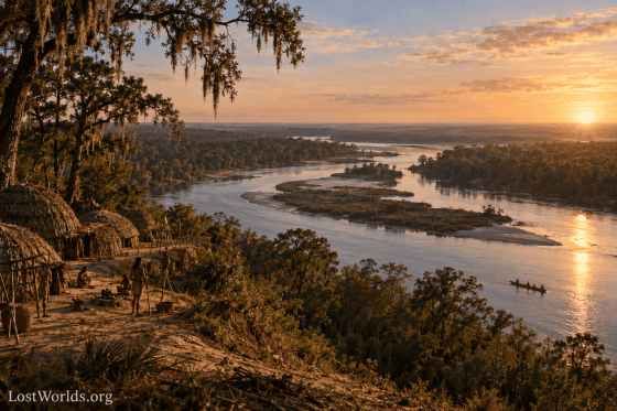
The final stage in the history of the name is the one that produced the modern hydronym. The sixteenth- and early seventeenth-century evidence examined above associates Altamaha, Tama, and Olatama with an inland town, province, or people. The river that today bears the name was not yet being called Altamaha in the surviving Spanish documentation. John Worth notes that seventeenth-century Spanish records instead called it el río de Santa Isabel—the River of Santa Isabel—in documents from 1630 and again in 1661. The Santa Isabel mission lay somewhere within the Altamaha drainage, probably near the forks of the Ocmulgee and Oconee. (Worth 1995, Appendix A, A-4)
The eventual transfer of Altamaha to the river appears to have occurred only after the original Tama population had been displaced from the Oconee interior. Westo attacks and other disruptions pushed Tama refugees south and east during the later seventeenth century. By 1681 Spanish mission records counted Yamasee populations in Guale and Mocama as well as more than 200 people at the Apalachee mission of Tama. Two years later, Worth writes that “chief Altamaha led the mission Yamassees out of Spanish territory en masse.” Some moved north toward Santa Elena and the emerging English settlements in Carolina. (Worth 1999, 15–16)
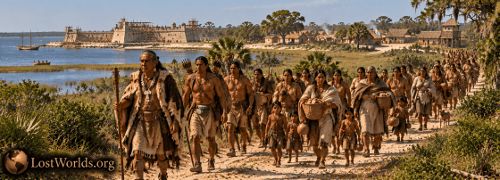
This is an important development in the life of the name. Altamaha was no longer merely an old sixteenth-century place-name. It had become attached to a surviving Tama/Yamasee political community and to its leadership. DePratter describes the migration into Carolina beginning in 1684 and identifies one of the earliest arrivals as “the Tama chief, Altamaha,” who had come from the vicinity of St. Augustine. The people arriving in Carolina included both Tama and Guale refugees, along with members of other communities, but Carolina officials increasingly grouped them together under the broader name Yamasee. (DePratter 1992, E-3)
The name followed them into South Carolina. By the early eighteenth century the Yamasee settlements around Port Royal were organized into Upper and Lower Towns. The Lower Towns preserved several names with deep roots in interior Georgia, including Altamaha, Ocute, and Chechessee/Ichisi. DePratter writes that the Lower Towns “were led by Chief Altamaha who resided in a town of that same name.” He further argues that Altamaha, Ocute, and Chechessee were named after earlier Tama towns and were probably occupied largely by people descended from the former Tama chiefdom. (DePratter 1992, E-4)
The wording “Chief Altamaha” can easily create the impression that Altamaha was simply the personal name of an individual. The Carolina records suggest something more complicated. Swanton noted that early South Carolina documents referred to the five Lower Yamasee towns as being headed by Altamaha or Aratomahaw, and that the recorded names of Yamasee “kings”—including the “Altamaha king”—“evidently refer to their towns.” (Swanton 1922, 97) Thus Altamaha may have functioned as a chiefly title or political designation: the chief or king of Altamaha town. Whether the chief recorded in Carolina around 1712 was the same individual who led the Yamasee migration in 1683 cannot presently be demonstrated, and may not be necessary. The name could remain attached to the office even when the officeholder changed.
This provides a remarkably clear example of how an old place-name could move with a displaced population. The documentary sequence is no longer simply:
Altamaha ? Tama ? Olatama
It now continues:
Tama people ? Chief/King of Altamaha ? Altamaha Town in South Carolina
The remaining question is how that same name became attached to the great river of Georgia.
By 1717 the transfer had unquestionably occurred. Sir Robert Montgomerie’s proposed Margravate of Azilia was defined in a formal grant as the territory lying “between the Rivers Allatamaha and Savanna.” Whatever the exact moment of naming, Allatamaha was by then established English geographical terminology for the river itself. (Montgomerie 1717, 14)
A remarkable document written twenty-one years later actually explains how Carolina officials understood the name to have reached the river. In 1738 William Bull, president of South Carolina, prepared a detailed representation for the Lords Commissioners for Trade and Plantations concerning the English-Spanish boundary. Bull stated explicitly:
“The River Alatamaha receives its name from a Tribe of Yamasee Indians” (Bull 1738)
He immediately added that their chief was known by the “name or Title of Alatamaha.” Bull further claimed that these Yamasee had formerly occupied the river country while allied with the Spanish and that after the Yamasee War they briefly returned to their “old Settlements on this River” before being driven away by the English. (Bull 1738)
Bull’s statement is unusually valuable because he distinguishes between the people, their chiefly title, and the river, while explicitly connecting all three. It was written in 1738, long after the original sixteenth-century Tama polity had disappeared, and in the context of an English-Spanish territorial dispute. His account therefore cannot establish that the original Tama of 1540 had occupied the lower Altamaha River; the earlier Spanish evidence examined in this paper places Tama much farther inland on the Oconee. Indeed, during the seventeenth century the Spanish were still calling the modern Altamaha the River of Santa Isabel. (Worth 1995, Appendix A)
What Bull does preserve is an eighteenth-century colonial explanation for the transfer of the name to the river. By his time the chain of association was still remembered: an Altamaha/Tama people, an Altamaha chief or chiefly title, and finally the Alatamaha River. His wording even preserves the ambiguity visible in the Carolina documents by calling Altamaha a “name or Title,” rather than unequivocally treating it as a personal name. (Bull 1738)
The documentary sequence can therefore be reconstructed more fully:
Altamaca / Altamaha — interior Georgia town or polity, 1540
Tama / Olatama — Oconee Valley province and head town, late sixteenth–early seventeenth century
Tama / Yamasee refugees — Spanish mission frontier, later seventeenth century
Altamaha — chief or chiefly title carried into Carolina
Altamaha Town — head town of the Lower Yamasee in South Carolina
Allatamaha / Alatamaha River — established English hydronym by the early eighteenth century
The modern river name therefore does not appear in the documentary record as an ancient hydronym carried unchanged from the sixteenth century. The evidence instead points toward a later transfer of an older Indigenous political and geographic name onto the river. The original Tama polity disappeared, but its name survived among displaced people, became attached to a town and its leadership in South Carolina, and ultimately returned to Georgia as the name of one of the Southeast’s great rivers.
Contact with the Santee/Sati
The South Carolina records also provide evidence that the Yamasee and the Santee occupied overlapping political and military networks during the years immediately before the Yamasee War. In John Barnwell’s 1711–1712 expedition against the Tuscarora, warriors from both peoples served in the same Carolina force. Barnwell organized the Yamasee with Cusabo, Yuchi, and Apalachee warriors, while the Santee were grouped with Congaree, Wateree, Sugeree, Catawba, Sutteree, and Waxhaw contingents. Swanton noted that Barnwell appears to have deliberately grouped neighboring or related peoples together within individual companies. The two peoples were therefore not serving in the same company, but Yamasee and Santee warriors were participating in the same expedition and moving within the same larger colonial military network. (Swanton 1922, 32–33)
Only a few years later, that relationship took on a very different character. The Santee are reported to have joined the Native resistance to South Carolina during the Yamasee War of 1715. In 1716 the colony fought a separate campaign against the Santee and Congaree, while Etiwaw and Cusabo warriors supported the English. (Swanton 1952, 98; Swanton 1922, 71) The surviving records do not demonstrate that the Santee were under Yamasee leadership or that the Altamaha chief personally coordinated with them. They do show, however, that Yamasee and Santee warriors had already participated in the same regional military system before 1715 and that both peoples subsequently became involved in the wider rupture between South Carolina and its former Native allies.
If the Santee name does preserve the older Sati form examined elsewhere in this series, the connection is especially noteworthy. The historical record would then place people carrying the Tama/Altamaha name and people carrying the Sati/Santee name within the same South Carolina military and political world at precisely the period when both names were still actively attached to Native communities.
The linguistic comparison adds one final point of interest. The Kanza/Kaw Siouan form ttáma, “town,” is not presently documented in Catawba, the best-attested Siouan language of South Carolina. Nor can it be checked directly against the historic Santee/Sati language, because, as Swanton noted, “No words of the Santee language have come down to us” (Swanton 1952). The absence of a surviving Santee vocabulary therefore prevents any direct test of whether the South Carolina Sati used a tama-type settlement term. The broader Siouan comparison nevertheless remains relevant because related “town” forms occur elsewhere in the family, including Kanza/Kaw and southeastern Biloxi. (Rankin et al. 2015)
Conclusion
The documentary trail begins with an Indigenous settlement or polity, not with the modern Altamaha River. De Soto’s chroniclers preserve Altapaha, Altamaca, and Altamaha in 1540. By the late sixteenth century Spanish documents regularly use the shorter form Tama. In 1602 Juan de Lara called the provincial capital Olatama, while Governor Gonzalo Méndez de Canço called the destination of that same expedition Tama. Across those changing forms, Tama is the recurring element. That observation is the conclusion of this paper; the cited sources document the forms themselves but do not propose that Tama was their underlying root.
Its original meaning remains unknown. Kanza/Kaw Siouan ttáma, “town,” provides an exceptionally close comparison, while Choctaw támaha, also “town,” provides another. Yet Gatschet’s comparative vocabulary shows that támaha is not the ordinary Muskogean-wide term for a settlement: Chickasaw, Alabama, Koasati, Creek, Seminole, Hitchiti, and Mikasuki use other forms. The Comparative Siouan Dictionary independently treats the broader tama/tawa-type settlement term as widely diffused across linguistic boundaries. Hitchiti itself uses ókli/úkli for “town,” while its -ali morphology may instead help explain the later form Tamali. (Gatschet 1884; Rankin et al. 2015; Swanton 1922)
The later history of the name demonstrates why language, population, and place-name should not automatically be treated as the same thing. As the original Tama polity fragmented during the seventeenth century, people carrying the name moved toward the Spanish mission frontier and eventually into South Carolina. There Altamaha became associated with a Yamasee chief or chiefly title and with an Altamaha town among the Lower Yamasee. South Carolina records subsequently remembered the river itself as taking its name from this Yamasee group and its Altamaha leader. By the early eighteenth century Allatamaha/Alatamaha was established as the English name of the Georgia river. (Swanton 1922; Worth 1999; DePratter 1992; Bull 1738)
The sequence therefore shows the name doing exactly what an inherited place-name can do when populations migrate and political systems collapse:
Altamaha / Altamaca ? Tama ? Olatama ? Tamali / Altamaha people ? Altamaha chief or title ? Altamaha town ? Altamaha River
The name did not remain fixed to one settlement, one population, or even one type of geographic feature. It traveled with people, was reshaped in new linguistic environments, became attached to political leadership, and ultimately returned to the landscape as a river name.
The South Carolina evidence adds another intriguing connection. Yamasee and Santee warriors participated in the same Carolina military system before the Yamasee War, and the Santee later joined the wider resistance to the colony. The language of the historic Santee/Sati cannot be compared directly with ttáma because no Santee vocabulary survives. Catawba does not preserve the form, but related “town” words occur elsewhere in Siouan, including Kanza/Kaw and southeastern Biloxi. (Swanton 1922, 1952; Rankin et al. 2015) This does not establish that the South Carolina Sati used tama, but it places people carrying the Sati/Santee and Tama/Altamaha names within the same early-eighteenth-century Carolina political world.
The broader landscape makes the linguistic question more than an isolated word comparison. Tama stood near a major Oconee crossing. Usatipa occurs in the same late-sixteenth-century political geography. Ocmulgee occupied the neighboring Fall Line to the west and has archaeological evidence consistent with migration from eastern Tennessee or northwest Georgia. The Lacoda Trail began at the Savannah River Fall Line to the east near Augusta which led to the Sautee-Nacoochee Sati Corridor. Etowah belonged to a northern Georgia landscape tied archaeologically to population movements from the Middle Cumberland and Central Mississippi regions. Previous work in this series has identified Savannah–Augusta–Nacoochee, Satilla, Ocmulgee, and Appalachian routes that could have connected these places.
One possible explanation is that Siouan-speaking merchants, migrants, or other travelers participated heavily enough in Mississippian exchange for portions of their settlement vocabulary to circulate beyond communities in which Siouan languages predominated. That remains a hypothesis. What the documentary history of Altamaha demonstrates much more securely is the mechanism by which such a name could survive: names can outlive the communities that coined them, move with displaced populations, acquire new linguistic forms, and become attached to entirely new places.
The people who later carried the name did not necessarily create it, and the people who created it did not necessarily remain where Europeans first recorded them.
The modern Altamaha River may preserve one of those older names—not because the river was always called Altamaha, but because the name survived long enough to find its way back onto the map of people who did not originate the name but kept it as a placename nonetheless once more demonstrating how a name can long outlive the people who created it and be adopted by people who have no understanding of its origins.
References
Bull, William. 1738. “Representation to the Lords Commissioners for Trade and Plantations,” May 25, 1738. In Letters from Georgia, v. 14203, 1737 June–1739 January. Transcripts of the Earl of Egmont Papers, ms1786, Box 2, Volume 14203. Hargrett Rare Book and Manuscript Library, University of Georgia Libraries.
Clayton, Lawrence A., Vernon James Knight Jr., and Edward C. Moore, eds. 1993. The De Soto Chronicles: The Expedition of Hernando de Soto to North America in 1539–1543. Vol. 1. Tuscaloosa: University of Alabama Press.
Daniels, G. C. 2026a. “Reconsidering Echetee and Hitchiti: A Source Audit of a Contested Southeastern Place-Name.” LostWorlds.org, September 17, 2026.
Daniels, G. C. 2026b. “Reconsidering Satilla: A Source Audit and Argument for a Sati/Itsati/Santee Origin.” LostWorlds.org, September 18, 2026.
Daniels, G. C. 2026c. “The Santee Sioux Connection to Etowah and Ocmulgee: Were Georgia’s Great Mound Centers Built Around an Ancient Merchant Network?” LostWorlds.org, September 10, 2026.
Daniels, G. C. 2026d. “The Sati Corridor: Tracing a Santee Merchant Route from the Savannah River through the Southern Appalachians to the Tennessee-Mississippi Exchange Network.” LostWorlds.org, 2026.
DePratter, Chester B. 1992. Yamasee Indian Towns in the South Carolina Lowcountry, 1684–1715. National Register of Historic Places Multiple Property Documentation Form. South Carolina Institute of Archaeology and Anthropology, University of South Carolina.
Gatschet, Albert S. 1884. A Migration Legend of the Creek Indians, with a Linguistic, Historic and Ethnographic Introduction. Vol. 1. Philadelphia: D. G. Brinton.
King, Adam. 2020. “The Cahokian Diaspora, Etowah, and South Appalachian Mississippian.” In Cahokia in Context: Hegemony and Diaspora, edited by Charles H. McNutt and Ryan M. Parish, 352–365. Gainesville: University Press of Florida.
Montgomerie, Robert. 1717. A Discourse Concerning the Design’d Establishment of a New Colony to the South of Carolina, in the Most Delightful Country of the Universe. London.
Mooney, James. 1900. “Myths of the Cherokee.” In Nineteenth Annual Report of the Bureau of American Ethnology, 1897–98, Part 1. Washington, DC: Government Printing Office. Published 1902.
Rankin, Robert L., Richard T. Carter, A. Wesley Jones, John E. Koontz, David S. Rood, and Iren Hartmann, eds. 2015. Comparative Siouan Dictionary. Leipzig: Max Planck Institute for Evolutionary Anthropology.
Sullivan, Lynne P., Kevin E. Smith, Scott C. Meeks, and Shawn M. Patch. 2024. “Tracking Mississippian Migrations from the Central Mississippi Valley to the Ridge and Valley with a Unified Absolute Chronology.” American Antiquity 89 (2): 221–237.
Swanton, John R. 1922. Early History of the Creek Indians and Their Neighbors. Bureau of American Ethnology Bulletin 73. Washington, DC: Government Printing Office.
Swanton, John R. 1931. Source Material for the Social and Ceremonial Life of the Choctaw Indians. Bureau of American Ethnology Bulletin 103. Washington, DC: Government Printing Office.
Swanton, John R. 1952. The Indian Tribes of North America. Bureau of American Ethnology Bulletin 145. Washington, DC: Government Printing Office.
Thompson, Victor D., Jennifer Birch, Raelynn Butler, Alex Cherkinsky, Carey J. Garland, Greg Luna Golya, Carla Hadden, Turner Hunt, and J. Mark Williams. 2026. “Collaborative Archaeology, Public Parks, and the Importance of Chronology at Ocmulgee Mounds National Historical Park.” American Antiquity 91 (1): 183–206.
Worth, John E. 1993. “Prelude to Abandonment: The Interior Provinces of Early Seventeenth-Century Georgia.” Early Georgia 21: 24–58.
Worth, John E. 1994. “Late Spanish Military Expeditions in the Interior Southeast, 1597–1628.” In The Forgotten Centuries: Indians and Europeans in the American South, 1521–1704, edited by Charles Hudson and Carmen Chaves Tesser, 104–122. Athens: University of Georgia Press.
Worth, John E. 1995. “The Early Seventeenth Century Locations of Tama and Utinahica.” Appendix A in Chad O. Braley, Historic Indian Period Archaeology of the Georgia Coastal Plain. University of Georgia Laboratory of Archaeology Series, Report No. 34; Georgia Archaeological Research Design Paper No. 10. Athens: University of Georgia.
Worth, John E. 1999. “Yamassee Origins and the Development of the Carolina-Florida Frontier.” Paper prepared for the Fifth Annual Conference of the Omohundro Institute of Early American History and Culture, Austin, Texas, June 12, 1999.