The Virginia Yesá
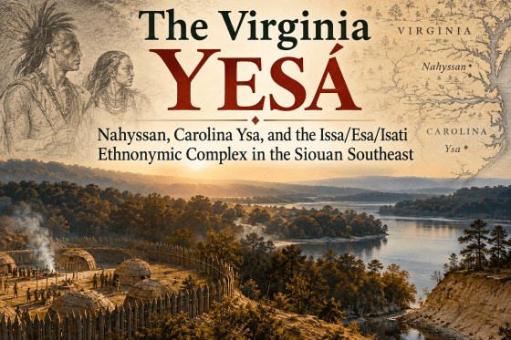
A Siouan Source Audit of Nahyssan, Carolina Ysa, and the Issa/Esa/Isati Ethnonymic Complex
Abstract
The Indigenous peoples conventionally known in colonial records as Saponi, Tutelo, Occaneechi, Nahyssan, and related Eastern Siouan communities occupied a strategic landscape extending across the Virginia and Carolina Piedmont and into the Appalachian interior. Their names, however, are unusually difficult to reconcile. Seventeenth-century English sources record Nessoneicks and Nahyssan, while nineteenth-century Tutelo descendants told linguist Horatio Hale that their proper national name was Yesang or Yesah, with a faintly nasal final vowel. Hale himself proposed that this self-designation lay behind the earlier Nahyssan.
This paper conducts a source audit of the Virginia Yesá problem by separating directly attested self-designations from names transmitted through Algonquian, Iroquoian, and European intermediaries. It also reconstructs the people behind those names through seventeenth- and eighteenth-century eyewitness testimony and archaeology. The resulting picture is of politically organized communities engaged in agriculture, hunting, craft production, warfare, diplomacy, and long-distance exchange. John Lederer’s 1670 account is especially important: he described Sapon as a village of the Nahyssans, characterized the Nahyssan ruler as an “absolute Monarch,” and reported seeing quantities of unbored pearls in Nahyssan ritual buildings that the people said had been taken as spoils in warfare against Indians of Florida.
Archaeological evidence from the Wade site and the wider Dan River sphere places probable ancestral Saponi and related Eastern Siouan populations within a broad Mississippian-era interaction network involving copper, marine shell, socially differentiated burials, plaza-centered settlements, and selected Mississippian religious imagery. Their settlements repeatedly occupied major river arteries, trading-path crossings, confluences, and Appalachian gateways.
The Virginia evidence also invites comparison with the Carolina Ysa/Yssa recorded during the Juan Pardo expeditions and with the broader Issa/Ysa/Isati/Sati phonetic complex documented among Siouan-speaking peoples. The relationship among these names cannot yet be considered demonstrated in every instance, but their phonetic, geographic, archaeological, and historical correspondences make them an important problem in the ethnohistory of the Eastern Siouan Piedmont.
Introduction
The colonial record of the Virginia and Carolina Piedmont preserves a bewildering assortment of Indigenous names. Saponi, Tutelo, Totero, Nahyssan, Occaneechi, Manahoac, Monacan, and several less familiar forms appear in accounts written by explorers, traders, colonial officials, and later ethnologists. Some were Indigenous self-designations. Others were exonyms supplied by neighboring peoples. Still others may have designated towns, political subdivisions, confederated communities, or temporary coalitions rather than enduring ethnic groups.
One name stands apart because it was obtained directly from descendants of the people themselves.
In 1883, linguist Horatio Hale reported that his Tutelo informants identified their proper national name as Yesang or Yesah. Hale emphasized that the final syllable possessed a faint nasal quality that could be nearly inaudible. The externally familiar name Tutelo or Totero, by contrast, was not their own national designation. Hale immediately suggested that Yesang/Yesah probably explained the much earlier colonial name Nahyssan (Hale 1883).
That observation creates an important historical problem. John Lederer had encountered “Sapon, a Village of the Nahyssans” in Virginia in 1670. Twenty years earlier, Edward Bland had been told of a population called the Nessoneicks living upriver in association with the Occaneechi and had passed abandoned fields called Manks Nessoneicks. Nearly two centuries later, Tutelo descendants still preserved Yesá as an internal national identity.
The Virginia evidence becomes still more intriguing when placed beside the sixteenth-century Carolina Ysa/Yssa documented in records of the Juan Pardo expeditions. Those records identify not only Ysa but also Ysa Chiquito, “Little Ysa,” demonstrating that the name could apply to more than one community or subdivision.
The question is therefore not simply whether several spellings look alike. It is whether historical sources, linguistic evidence, archaeology, geography, and eyewitness descriptions collectively reveal an enduring Yesá-associated identity whose name was repeatedly reshaped by intermediary languages and colonial orthographies.
Yesá: The Indigenous Self-Designation
Hale’s testimony provides the strongest starting point because the name came directly from Tutelo descendants rather than from colonial intermediaries. His informants distinguished between the names outsiders used for them and their own national designation, Yesang or Yesah.
The ending deserves particular attention. Hale explained that the final sound was faintly nasalized and might be heard inconsistently. Consequently, his Yesang should not be read as though the word necessarily ended in the English consonant cluster -ng. It represents a nasalized final vowel, approximately Yesã.
This phenomenon has an important parallel elsewhere in Siouan transcription. Dakota orthographies have represented nasal vowels with forms such as n, ŋ, and later dedicated nasal symbols. The Eastern Dakota name commonly rendered in English as Santee occurs in forms including Issati, Isanti, Izatys, and modern Dakota Isáŋyathi. A previous source audit traced the historical forms Isati/Isanti and Sati/Santee and showed that their apparent alternation is partly the product of nasalization and transcription practice. In the spellings containing n, the n can represent nasalization of the preceding vowel rather than an independently pronounced consonant. Thus forms such as Isati/Isanti and Sati/Santee preserve closely related renderings of an Issa-/Isą-/Isati-/Sati- ethnonymic stem, with some recorders marking the nasalized vowel explicitly and others omitting it (Daniels 2026). The same orthographic issue is relevant to Hale’s Yesáⁿ/Yesang: the written n or ng does not represent a separate consonantal ending, but instead records nasalization of the final vowel.
The comparison is methodologically important. A written n or ŋ in a Siouan name need not represent the sort of independent consonant an English reader would assume. It may mark nasalization of the preceding vowel. Hale’s Yesang therefore belongs beside Yesá/Yesã, just as Isanti and Isáŋyathi belong within the historical complex that produced English Santee.
This does not by itself establish that Virginia Yesá and Dakota Isanti were historically the same population. It does establish that the superficial differences among forms such as Ysa, Yesá, Isanti, Sati, and Santee cannot be evaluated simply by comparing their English spellings.
Hale did not provide a secure literal etymology for Yesá. What he established was more fundamental: Yesá was the people’s own inherited national name.
Its persistence is itself significant. By Hale’s time, Tutelo descendants had lived for generations among the Cayuga and other Haudenosaunee peoples, where Iroquoian-derived forms such as Tutelo, Totero, and Toderochrone dominated outside usage. Yet when asked their own national identity, Hale’s informants still supplied Yesá.
The survival of the name demonstrates how an Indigenous self-designation can remain largely invisible in European documentation while multiple external names dominate the written record.
Nessoneicks: The 1650 Virginia Evidence
The earliest Virginia form potentially relevant to the Yesá problem appears in Edward Bland’s The Discovery of New Brittaine, describing his expedition of 1650.
Bland traveled with an Appamattuck guide named Pyancha. While discussing the country farther inland, Pyancha told the English party that upriver lived:
“the Occonacheans and the Nessoneicks.”
Bland later reported traveling through:
“the old fields of Manks Nessoneicks”
only a short distance southwest of Fort Henry near modern Petersburg.
The second reference is particularly important because it associates the name with an abandoned settlement landscape rather than merely distant hearsay. The Nessoneicks had apparently occupied territory nearer the eastern edge of the Piedmont before the group known to Bland’s guide became associated with the upper interior.
The linguistic form also reflects the circumstances under which Bland obtained the name. Pyancha was Appamattuck and therefore Algonquian-speaking. Bland was not recording a Nessoneicks self-designation directly; he was hearing an Algonquian speaker’s name for an interior population.
Frank Speck recognized this problem in 1935. He considered Nessoneicks synonymous with Nahissan and specifically observed that the name contained an Algonquian plural ending plus an additional English plural (Speck 1935).
A segmentation consistent with Speck’s observation is therefore:
Nesson + -eick + -s
On this reading, -eick represents the Algonquian plural element and final -s is the additional English plural. The ethnonymic portion is approximately Nesson.
As seen in Hale’s Yesáⁿ/Yesang, a final written n may record nasalization of the preceding vowel rather than a fully pronounced final consonant. If the same possibility applies to Nesson, the surviving stem can be considered approximately:
Nessõ / Nessã
or, analytically:
N- + essõ/essã.
The principal unresolved features would then be the initial N- and the precise vowel quality represented by Bland’s spelling.
The resulting comparison is considerably closer:
Ysa / Yssa
Yesá / Yesã
N-essã / N-essõ
Nahyssan
This does not establish a regular derivation among the forms. The initial N- remains unexplained, and colonial spelling does not permit exact reconstruction of the underlying vowels. But once the probable Algonquian plural and English plural are removed and the possibility of nasalization is recognized, Nessoneicks appears far less remote from the Yesá/Ysa complex than the unsegmented spelling suggests.
The form is especially important because it reached Bland through an Algonquian intermediary. An Algonquianized exonym need not reproduce the foreign self-name perfectly. It may incorporate native morphology, phonological reshaping, or an added element whose original function is no longer transparent.
“Little Nessoneicks”?
Bland’s phrase Manks Nessoneicks introduces another intriguing possibility.
John Swanton proposed that Manks was a corruption of Powhatan Tanx/Tanks, “little.” The underlying Powhatan word is independently attested. William Strachey recorded Tanxpowatan, explicitly glossed as “Little Powhatan.”
If Swanton’s emendation is correct, Bland’s phrase would mean approximately:
Little Nessoneicks.
The surviving text still reads Manks, so this interpretation cannot be treated as established fact. It is nevertheless notable because Spanish sources from the Carolina Piedmont approximately eighty years earlier record:
Ysa Chiquito — Little Ysa.
The parallel does not prove that Ysa and Nessoneicks were identical. It does suggest that both names could designate a broader population possessing smaller or subordinate communities identified by the same ethnonym.
Nahyssan and Sapon in 1670
The first detailed description of a Nahyssan community comes from John Lederer’s expedition of 1670.
Lederer reached:
“Sapon, a Village of the Nahyssans”
on the upper Roanoke drainage.
The wording is important. Sapon is not presented as synonymous with Nahyssan. It is explicitly described as a village of the Nahyssans, suggesting that Nahyssan may have functioned as a broader political, ethnic, or confederational designation encompassing Sapon and perhaps other communities.
Lederer also described Pintahae as the residence of the Nahyssan ruler and characterized the political system in unusually strong terms:
“This Nation is governed by an absolute Monarch.”
He further described the people as tall, warlike, and rich.
The phrase “absolute Monarch” is Lederer’s seventeenth-century European description of an Indigenous political institution, but it should not be dismissed as generic terminology. Lederer did not routinely describe every Native headman he encountered this way. His language, combined with the distinction between Sapon and the ruler’s residence at Pintahae, indicates that he perceived a comparatively centralized authority extending across more than one settlement. Lederer’s original account immediately joins this political description to his observations of Nahyssan wealth and warfare.
A Sati/Santee Political Parallel
Lederer’s description has a striking parallel among another eastern Siouan people whose name falls within the Issa/Ysa/Isati/Sati phonetic complex.
That relationship requires brief explanation. A previous source audit documented early Sati forms for the people later known to the English as Santee in South Carolina and compared them with northern Dakota forms including Issati, Isanti, Izatys, and Isáŋyathi. The study argued that these spellings preserve a historically related Issa/Isą/Isati/Sati name complex in which nasalization and subsequent transcription obscure the phonetic relationship among the forms (Daniels 2026).
The sequence may be summarized schematically as:
Issa / Ysa / Isą → Isati / Isanti → Sati / Santee
without implying that every form represents a simple linear evolution from one immediately preceding form. The important point is that Sati/Santee does not enter the present comparison merely because it happens to resemble Yesá. Its position within the broader phonetic complex has already been established through a separate source audit.
Against that background, the political parallel becomes particularly significant.
When John Lawson visited the South Carolina Santee in 1701, he called their chief:
“the most absolute Indian Ruler in these Parts”
and stated:
“He can put any of his People to Death”
for an offense the chief considered worthy of such punishment. Lawson explicitly remarked that this degree of authority was unusual among the Native peoples with whom he was familiar. He then described the deceased previous Santee ruler as a man of great power who had possessed an equally extensive prerogative, indicating that the authority was associated with the office rather than merely the personality of one chief.
The comparison is unusually close.
1670 — Nahyssan: Lederer describes an “absolute Monarch.”
1701 — Sati/Santee: Lawson describes “the most absolute Indian Ruler in these Parts” and explicitly says that his authority included the power to impose death.
The similarity does not demonstrate that Nahyssan and Santee political institutions were identical or that one polity descended directly from the other. It does, however, add a cultural correspondence to the phonetic comparison. Two eastern Siouan populations associated with the Issa/Ysa/Isati/Sati name complex were independently described by European eyewitnesses as possessing unusually concentrated chiefly authority.
Florida War Spoils and Long-Distance Warfare
One of Lederer’s most important observations concerns objects stored in Nahyssan ritual buildings.
He reported seeing:
“great store of Pearl unbored”
kept in small temples or oratories. Lederer then stated that the Nahyssan had:
“won [them] amongst other spoyls from the Indians of Florida.”
The wording is explicit. Lederer was not merely speculating that the pearls originated somewhere to the south. He recorded them as war spoils from Indians of Florida.
Such long-distance warfare was not anomalous in the Southeast.
Sixteenth-century French accounts from Florida describe organized Native armies traveling considerable distances against hostile polities. The French themselves participated in one such expedition when forces associated with Fort Caroline accompanied Chief Outina against the Potano. French accounts describe scouts, military formations, ritual preparations, coordinated attacks, and political alliances extending well beyond a single settlement.
The same French sources place Florida polities within a much wider political geography extending toward the Appalachian interior. Laudonnière’s men heard of powerful chiefs associated with the mountains and encountered Native leaders who understood warfare, alliance, exchange, and access to valuable materials as parts of the same interregional political system.
Long-distance military routes remained prominent in later English records. By the seventeenth and eighteenth centuries, trails through the Appalachian valleys were explicitly identified as Warriors’ Paths or Warpaths. The Great Warrior Path through the Shenandoah and Appalachian valleys was used by Iroquois war parties moving south against Cherokee and Catawba communities, while southern warriors traveled north along overlapping corridors. The same paths that facilitated trade and diplomacy could become military highways during periods of conflict.
The Nahyssan claim therefore belongs within a well-documented Southeastern system in which armed parties could travel hundreds of miles along established routes to attack distant enemies.
The precise conflict in which the Nahyssan obtained their Florida pearls cannot presently be identified. Lederer does not name the Florida polity involved, the date of the campaign, or the route followed.
The fact that the pearls were kept in temples or oratories is equally important. They were not ordinary household valuables. War spoils acquired from a distant southern enemy had entered a ceremonial or chiefly treasury, linking warfare, prestige, political authority, and ritual life.
Trade and warfare need not have been separate systems. Long-distance exchange created relationships among distant populations, but those same relationships could produce rivalry, disrupted exchange, competition over routes, retaliation, and military conflict. The presence of established trade and war paths across the same geography makes such interaction structurally plausible, although Lederer does not tell us what particular dispute produced the Nahyssan campaign against Florida Indians.
Trade, Exploration, and the Appalachian Interior
Long-distance mobility continued to characterize the Saponi world in the early eighteenth century.
John Lawson visited the Saponi in 1701 and stayed with their king. He reported that the ruler had previously accompanied an English traveler on an expedition toward and into the Appalachian Mountains. The account portrays the Saponi leadership as familiar with routes extending far beyond the immediate Piedmont.
The king also maintained beaver traps and possessed horses, illustrating the degree to which the Saponi had entered the expanding colonial trade economy while retaining their own political system.
The evidence reveals two overlapping exchange systems.
The older Indigenous network involved:
- warfare and alliance;
- ritual prestige goods;
- pearls;
- marine shell;
- copper;
- diplomacy;
- interregional travel.
The expanding colonial economy increasingly added:
- deerskins and beaver pelts;
- firearms and ammunition;
- cloth;
- metal tools;
- horses;
- colonial trading posts.
European commerce altered the volume and character of exchange, but it did not create the transportation corridors or the practice of long-distance interaction.
Political Change: Monarch, King, and Council
The eyewitness descriptions provide an unusual opportunity to watch Yesá-associated political organization transform over less than fifty years.
1670: Lederer
Lederer described the Nahyssan as governed by an:
“absolute Monarch.”
The ruler resided at Pintahae, while Sapon was described as one Nahyssan village.
1701: Lawson
John Lawson encountered a Saponi king, but the king did not rule alone. When Tutelo representatives requested the release of captured Seneca prisoners, the ruler consulted his counsellors before agreeing to the request.
Lawson also recorded plans by the Saponi, Tutelo, and Keyauwee to live together for mutual defense.
1716: Fontaine
John Fontaine’s visit to the Saponi settlement adjacent to Fort Christanna reveals another major change. He wrote that the people then had no king and were governed instead by twelve old men, whose collective decisions bound the community.
The sequence is striking:
1670 — centralized Nahyssan monarch
1701 — Saponi king with counsellors
1716 — council of twelve elders, no king
The difference should not be dismissed as inconsistent reporting. The period between Lederer and Fontaine witnessed warfare, epidemic disease, slave raiding, Iroquois attacks, English expansion, population decline, and the consolidation of formerly separate Native communities.
The political structure observed at Fort Christanna was therefore not necessarily the same institution that had governed the larger Nahyssan polity encountered by Lederer almost half a century earlier.
The Santee comparison reinforces the possibility that strong chiefly authority was not unique to Lederer’s Nahyssan. Lawson’s independent description of the South Carolina Sati/Santee chief shows that unusually concentrated rulership existed elsewhere within the eastern Siouan world at the beginning of the eighteenth century.
A Saponi Town in 1716
Fontaine provides the richest surviving eyewitness description of a Saponi settlement.
The houses formed a complete circle around a central open space, with their doors facing inward. Only a few passages led into the settlement. At the center stood the stump of a large tree that functioned as a public speaking platform from which leaders addressed the assembled community.
This arrangement provides a historical counterpart to the central-plaza settlement pattern found archaeologically throughout the Dan River cultural sphere.
Fontaine described substantial timber houses built from squared posts set into the earth, with bark roofs. Interior furnishings included:
- raised sleeping platforms;
- bear and deer skins;
- bullrush mats;
- pottery;
- wooden dishes;
- wooden trays.
He specifically noted that the wooden vessels were manufactured locally.
Agriculture and hunting formed the basis of subsistence. Women cultivated corn, while men hunted and trapped. Between the village and the river stood sweat houses in which heated stones created intense heat before participants plunged into the water.
Fontaine also witnessed formal military and ceremonial display. Approximately sixty young Saponi men appeared before Governor Alexander Spotswood wearing feathers, painted faces, distinctive hairstyles, and blankets. Boys practiced archery and performed a war dance in which movements represented attacks upon enemies.
These observations reveal a structured society with communal public space, craft production, agriculture, hunting specialization, military training, ceremonial performance, and formal systems of governance.
Archaeology and the Precolonial Saponi
The strongest archaeological candidate for an ancestral Saponi settlement is the Wade site (44CH62) on the Staunton River in Charlotte County, Virginia.
The Virginia Department of Historic Resources dates its principal occupation approximately AD 1000–1450 and considers its inhabitants probable ancestors of the historic Saponi.
The settlement contained:
- post molds;
- hearths;
- storage features;
- pottery;
- bone tools;
- pipes;
- shell ornaments;
- copper objects;
- burials.
The imported materials are particularly important. Marine shell and copper prestige objects demonstrate participation in exchange systems extending well beyond the immediate Piedmont.
One burial was especially elaborate, containing hundreds of bone disk beads, large and small shell ornaments, turtle-shell rattles, and tubular copper beads. The assemblage demonstrates both access to geographically distant materials and unequal distribution of prestige goods.
Later work at Wade has identified a central plaza and unusually elaborate mortuary treatment compared with many contemporary regional sites. Archaeologists working with the assemblage have investigated the community as a frontier population interacting with Dan River, Mississippian, and Chesapeake cultural systems.
Wade therefore provides a precolonial archaeological context for the kind of political and exchange complexity visible later in the documentary record.
The Wider Dan River and Eastern Siouan Sphere
Wade was not isolated.
By approximately AD 1300, large Dan River communities such as Belmont, Koehler, and Lower Saratown commonly consisted of circular or oval palisaded villages arranged around central plazas.
Their domestic material culture remained locally distinctive, especially in ceramics, but selected Mississippian objects and symbols increasingly entered these communities.
Archaeological research in the Philpott–Saratown corridor has identified:
- Mississippian-inspired effigy pipes;
- marine-shell gorgets;
- rattlesnake imagery;
- bird effigies;
- anthropomorphic figures bearing forked or “weeping-eye” motifs;
- copper ornaments.
These are not equivalent kinds of evidence.
Marine shell and copper demonstrate exchange. A decorated gorget, specialized effigy pipe, or recognizable religious image demonstrates the movement of ideas and symbolic systems, not merely raw material.
The pattern is therefore one of selective participation in a wider Mississippian interaction sphere. Eastern Siouan communities retained their own domestic traditions and ceramics while incorporating prestige materials and ideological forms circulating through the Southeast.
Calling them simply “Mississippian” would obscure these distinctions. Yet portraying them as isolated from the Mississippian world would be equally misleading.
Mounds and Mississippian Participation
Eastern Siouan populations were themselves mound builders, although their best-documented Virginia mounds differ from the large platform pyramids characteristic of major Mississippian capitals.
Archaeologists have documented a tradition of accretional burial mounds in interior Virginia. These monuments grew through repeated mortuary episodes and demonstrate formalized communal burial practices.
Farther south, historically Siouan-associated communities interacted directly with Mississippian mound centers. At Town Creek in North Carolina, a major Pee Dee Mississippian ceremonial center containing a platform mound and central plaza was later used for burials that Joffre Coe regarded as probably Siouan and potentially associated with Sara, Saponi, Occaneechi, or Keyauwee communities.
The evidence therefore points toward sustained interaction between eastern Siouan societies and the Mississippian ceremonial world rather than two isolated cultural systems.
A People of the Piedmont Corridors
The geographical distribution of Yesá-associated communities is one of the clearest recurring patterns in the evidence.
Their settlements repeatedly occupy or closely approach:
- major river arteries;
- confluences;
- ford zones;
- trading-path crossings;
- fall-line approaches;
- Appalachian gateways.
The probable ancestral Saponi Wade site stood directly on the Staunton River, which flows into the Roanoke system. Its shell and copper artifacts independently confirm long-distance connections.
Lederer’s Sapon likewise belonged to the upper Roanoke–Staunton world.
The Occaneechi, closely associated historically with Saponi and Tutelo communities, occupied one of the most strategically important positions in the region: the Dan–Staunton–Roanoke system. Their location helped make them major intermediaries in Piedmont exchange.
After the destruction of their earlier settlement, Occaneechi people relocated to the Eno River near present-day Hillsborough. Archaeology at the Fredricks site places the new village immediately beside the Great Trading Path near an important river crossing.
Bland’s Manks Nessoneicks old fields lay near the eastern Piedmont approaches to Fort Henry at the Appomattox Fall Line, which became a major English gateway into the interior trading network.
To the west, Tutelo communities occupied the approaches connecting the Virginia Piedmont with the Appalachian valleys and New River drainage. Their precise seventeenth-century town location remains debated, but the principal reconstructions place them in a major trans-Appalachian movement corridor.
This settlement geography cannot be explained solely as a search for transportation routes. River terraces also offered excellent agricultural soils and water resources. Yet the repeated combination is notable:
river corridors + crossings + trade paths + prestige goods + historically documented traders, diplomats, warriors, and guides.
The eastern Siouan Piedmont was not a collection of isolated villages. It was embedded in a transportation system connecting the Atlantic slope, Appalachians, Ohio drainage, Carolinas, and deeper Southeast.
The Carolina Ysa/Yssa Comparison
The Virginia Yesá evidence invites direct comparison with the Ysa/Yssa documented approximately a century earlier during the Spanish Juan Pardo expeditions in the Carolina Piedmont.
The Spanish records preserve several relevant forms, including Ysa/Yssa and Ysa Chiquito, “Little Ysa.”
The name should not be read according to modern English expectations. In the sixteenth-century Spanish orthographic environment in which it was recorded, initial Y can represent a vowel-like sound. Ysa is therefore approximately Ee-sa, bringing it phonetically much closer to Yesá than an English reading beginning with the consonant of yellow would suggest.
The comparison is therefore approximately:
Ysa / Yssa
Yesá / Yesã
N-essã / Nesson
Nah-yssan
The nasal quality is especially important because Siouan names repeatedly show instability in European representation of nasal vowels. The Issa/Ysa/Isati/Sati complex supplies an independent comparative example: northern forms such as Issati, Isanti, and Isáŋyathi coexist historically with Santee, while the South Carolina form Sati lacks the written n entirely but was nonetheless associated with later Santee. (Daniels 2026).
A previous source audit examined that evidence in detail and concluded that Issa/Ysa/Isati/Sati represents a meaningful phonetic complex rather than a collection of similarities produced solely by English spelling.
The Virginia evidence adds another set of forms to the problem.
Several correspondences deserve particular attention.
First, Ysa/Yssa is independently documented in the sixteenth-century Carolina Piedmont.
Second, Yesá is independently documented as the inherited self-name of an eastern Siouan population historically associated with Virginia and North Carolina.
Third, Nahyssan appears in seventeenth-century Virginia, and Hale himself proposed that it preserved the Yesá name.
Fourth, Nessoneicks, once probable Algonquian and English plural morphology is removed, reduces to approximately Nesson, while the final n may represent the same kind of nasalization documented by Hale in Yesang. The remaining form approaches N-essã, leaving the initial N- as one of the principal unresolved features.
Fifth, both the Carolina and Virginia records may preserve a “Little” subdivision: Ysa Chiquito and, if Swanton’s emendation is correct, Tanks Nessoneicks.
Sixth, the political evidence supplies an independent cultural parallel. Lederer’s Nahyssan were ruled by an “absolute Monarch,” while Lawson described the South Carolina Sati/Santee chief as “the most absolute Indian Ruler in these Parts” and explicitly stated that he possessed authority over life and death.
Seventh, both populations belonged to the same broad Piedmont–Appalachian interaction world characterized by long-distance movement, exchange, warfare, and strategic occupation of transportation corridors.
No single one of these correspondences establishes identity. Taken together, however, they make the Virginia Yesá–Carolina Ysa comparison substantially more than a superficial resemblance between two spellings.
Conclusion
The Virginia Yesá emerge from the historical record only when several layers of colonial naming are separated.
Horatio Hale’s Tutelo informants identified Yesang/Yesah as their own national name. Hale’s phonetic observations show that its ending was nasalized, producing approximately Yesã, rather than necessarily a word ending in a fully pronounced English -ng. Siouan orthographic practice elsewhere confirms that nasalization can be represented inconsistently with n, ŋ, or omitted entirely. The broader Issa/Ysa/Isati/Sati complex provides a particularly relevant comparison.
The earlier Virginia forms become more intelligible when examined in this light.
Nessoneicks came to Edward Bland through an Appamattuck Algonquian intermediary. Speck recognized that the form contains an Algonquian plural plus an English plural. A more appropriate analytical segmentation is therefore:
Nesson + -eick + -s.
If the terminal n of Nesson marks nasalization, as it does in comparable Siouan transcriptions, the remaining ethnonymic core approaches N-essã, leaving the initial N- and exact vowel quality as the principal unresolved differences from Ysa/Yesá.
Nahyssan, recorded directly within the Virginia interior by Lederer, supplies another intermediate form. Hale himself believed it preserved the later Yesá self-designation. Its initial Nah-/Na- remains unexplained, but the -yssan portion becomes considerably more suggestive when read alongside Hale’s explicitly nasalized Yesáⁿ.
The documentary evidence also reveals far more about these people than their names.
In 1670 Lederer encountered a Nahyssan polity with centralized leadership, subordinate settlements, ritual buildings, and stores of pearls explicitly said to have been captured in warfare against Indians of Florida. Long-distance Native military expeditions are independently documented elsewhere in the Southeast, where established warrior paths linked distant political regions.
The political evidence supplies another notable comparison. Lederer called the Nahyssan ruler an “absolute Monarch.” Thirty-one years later John Lawson described the South Carolina Sati/Santee ruler—whose name belongs to the independently established Issa/Ysa/Isati/Sati complex—as “the most absolute Indian Ruler in these Parts” and stated that his authority included the power to put subjects to death. The two descriptions do not prove common political institutions, but their similarity adds a cultural correspondence to the linguistic one.
By 1701 Lawson found Saponi leaders participating in Appalachian travel, diplomacy, trapping, and intertribal consolidation. Fontaine’s 1716 account reveals a circular plaza-centered town, substantial houses, local manufacture, corn agriculture, hunting, sweat houses, formal government, military training, and ceremonial performance.
Archaeology extends this world centuries deeper into the past. The Wade site, probably ancestral Saponi and occupied broadly between AD 1000 and 1450, contained a central plaza, prestige burials, copper, marine shell, and evidence of long-distance interaction. Across the wider Dan River sphere, eastern Siouan communities incorporated selected Mississippian symbols and prestige objects while retaining locally distinctive settlement and ceramic traditions.
Their geography is equally consistent. Yesá-associated peoples repeatedly occupied major rivers, trade-route crossings, confluences, fall-line approaches, and Appalachian gateways. Their historical roles as traders, guides, diplomats, warriors, and intermediaries reflect that strategic position.
Against this background, the resemblance between Virginia Yesá/Yesã, Carolina Ysa/Yssa, Virginia Nesson/Nahyssan, and the broader Issa/Ysa/Isati/Sati name complex becomes a substantive ethnohistorical problem rather than a coincidence of spelling.
The evidence does not yet establish that every occurrence represents the same tribe or a simple linear migration. It does establish a recurring set of closely related phonetic forms among Siouan populations occupying interconnected portions of the Southeast, accompanied by significant parallels in political organization, long-distance interaction, and corridor geography.
The Virginia Yesá therefore represent not an isolated eighteenth-century remnant but the surviving historical expression of a deeper eastern Siouan identity embedded within the political, commercial, ceremonial, and military networks of the late prehistoric and early colonial Southeast.
References
Bland, Edward. 1651. The Discovery of New Brittaine. Began August 27, Anno Dom. 1650. London: Thomas Harper for John Stephenson.
Byrd, William II. 1841 [1728]. The History of the Dividing Line Betwixt Virginia and North Carolina. Richmond.
Christie, Karenne Wood, et al. 2017. The High Plains Sappony of Person County, North Carolina and Halifax County, Virginia: Sites of Significance in the Christie Indian Settlement. Virginia Department of Historic Resources.
Daniels, G. C. 2026. Before Santee: The Issa–Isą Ethnonymic Stem in Siouan-Catawban Historical Onomastics.
Davis, R. P. Stephen Jr., Patrick C. Livingood, H. Trawick Ward, and Vincas P. Steponaitis, eds. Excavating Occaneechi Town: Archaeology of an Eighteenth-Century Indian Village in North Carolina. Chapel Hill: Research Laboratories of Archaeology, University of North Carolina.
Fontaine, John. 1716. “Journal of John Fontaine.” Later published in Memoirs of a Huguenot Family.
Hale, Horatio. 1883. The Tutela Tribe and Language. Philadelphia.
Hudson, Charles M., ed., and Herbert E. Ketcham, trans. 1990. The Juan Pardo Expeditions: Spanish Explorers and the Indians of the Carolinas and Tennessee, 1566–1568. Washington, D.C.: Smithsonian Institution Press.
Laudonnière, René Goulaine de. 1586. L’Histoire notable de la Floride. Paris.
Lawson, John. 1709. A New Voyage to Carolina: Containing the Exact Description and Natural History of That Country. London.
Lederer, John. 1672. The Discoveries of John Lederer in Three Several Marches from Virginia to the West of Carolina and Other Parts of the Continent. Collected and translated by Sir William Talbot. London.
Le Moyne de Morgues, Jacques. 1591. Brevis Narratio eorum quae in Florida Americae Provincia Gallis Acciderunt. Frankfurt.
Myer, William E. 1928. “Indian Trails of the Southeast.” Forty-Second Annual Report of the Bureau of American Ethnology. Washington, D.C.: Smithsonian Institution.
Oliverio, Giulia R. M. 1997. A Grammar and Dictionary of Tutelo. Ph.D. dissertation, University of Kansas.
Riggs, Stephen Return. 1893. Dakota Grammar, Texts, and Ethnography. Contributions to North American Ethnology 9. Washington, D.C.: Government Printing Office.
Speck, Frank G. 1935. “Siouan Tribes of the Carolinas as Known from Catawba, Tutelo, and Documentary Sources.” American Anthropologist 37(2): 201–225.
Strachey, William. 1849 [ca. 1612]. The Historie of Travaile into Virginia Britannia. London: Hakluyt Society.
Swanton, John R. 1952. The Indian Tribes of North America. Bureau of American Ethnology Bulletin 145. Washington, D.C.: Smithsonian Institution.
Virginia Department of Historic Resources. 2003. National Register of Historic Places Registration Form: Wade Archaeological Site (44CH62), Charlotte County, Virginia.
Virginia Department of Historic Resources. “Wade Archaeological Site.” Virginia Landmarks Register.