Black Warrior’s Path
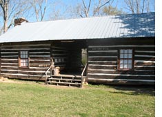
 Along the western edge of the Oakville Ceremonial Woodland Mound is the Black Warriors’ Path or Mitchell Trace. The path was a major trading route utilized by Indian people. It does not appear accidental that the Black Warriors’ Path (Mitchell Trace) connected areas of cultural importance to the Indian people of the Tennessee River Valley, the Black Warrior River Valley, and the Chattahoochee River Valley. The path connected the Tennessee River crossing at Elk River Shoals to the Chattahoochee River in Russell County, Alabama. The Black Warriors’ Path is clearly shown on the 1818 Melish map crossing the west fork of Flint Creek and Elam Creek. These crossings are still clearly visible just one mile north of the Oakville Copena Mound. Davy Crockett traveled the Black Warriors’ Path (Mitchell Trace) in 1813 during the Creek Indian War. It is thought that during the 1850’s the route became a part of the vast Wheeler Plantation. Black Warriors’ Path (Mitchell Trace) was used after the Creek Indian War to remove many Creeks west. The probable date of passage of a detachment of Creeks who passed through Oakville Indian Mounds Park along the Black Warriors’ Path (Mitchell Trace) was on December 19, 1935.
Back to Map of Alabama Indian Sites
Internal Links:
External Links: